Area Overview for LU3 3NT
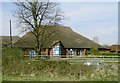
Photos of LU3 3NT

Area Information
LU3 3NT is a small, tightly knit residential area in England, spanning 28 hectares and home to 2,345 residents. With a population density of 100 people per square kilometre, it is a low-density, community-focused postcode. The area is characterised by a mature demographic, with a median age of 47 and a majority of residents aged between 30 and 64. This suggests a stable, established community, likely with families and long-term residents. The area’s compact size means amenities and services are within practical reach, while its location offers connectivity to nearby towns and transport hubs. Daily life here is shaped by proximity to schools, rail networks, and retail options, creating a balance between suburban comfort and accessibility. The presence of a mix of housing types, predominantly owner-occupied homes, reflects a settled population. For those seeking a quiet, family-friendly environment with practical infrastructure, LU3 3NT offers a blend of convenience and tranquillity.
- Area Type
- Postcode
- Area Size
- 28.0 hectares
- Population
- 2345
- Population Density
- 100 people/km²
The property market in LU3 3NT is dominated by owner-occupied homes, with 68% of residents owning their properties. This high home ownership rate indicates a stable, long-term community rather than a transient rental market. The accommodation type is primarily houses, which is unusual for areas with limited land, suggesting that properties are likely to be larger and more spread out. The small area size of 28 hectares means the housing stock is limited, potentially making the market competitive for buyers. However, the focus on owner-occupied homes implies strong demand from families seeking established, low-density living. For buyers, this means opportunities are likely to be limited to existing properties rather than new developments. The proximity to transport links and amenities may also influence property values, as these factors enhance the area’s appeal for those prioritising convenience and connectivity.
House Prices in LU3 3NT
Showing 1 properties
| Address | Type | Beds | Baths | Last Sale Price | Last Sale Date | |
|---|---|---|---|---|---|---|
| Pasque Hospice, Great Bramingham Lane, Luton, LU3 3NT | commercial | - | - | - | - |
Energy Efficiency in LU3 3NT
The lifestyle in LU3 3NT is shaped by its proximity to essential amenities, including five retail venues such as Sainsburys Bramingham, Aldi Bramingham, and M&S Streatley Luton BP. These shops provide everyday convenience, from grocery shopping to fueling vehicles. The area’s rail network offers easy access to nearby towns, while the nearby London Luton Airport enhances travel options for residents. The presence of multiple rail stations and a major airport suggests a lifestyle that balances suburban tranquillity with urban accessibility. The compact size of the area means amenities are within walking or short driving distance, reducing the need for lengthy commutes. This combination of retail, transport, and connectivity creates a practical, efficient environment for daily life, supporting both routine needs and occasional travel.
Amenities
Schools
The nearest schools to LU3 3NT include Sundon Lower School, which operates as both a primary school and an academy with an Ofsted rating of ‘good’. This dual designation provides families with options for early education and continued schooling under a single institution. The presence of a primary school suggests that the area is well-suited for families with young children, offering immediate access to local education. The academy status may indicate a focus on academic standards or specialist provision, though specific curriculum details are not provided. With a ‘good’ rating, the school meets national benchmarks for quality, ensuring a reliable educational foundation. The availability of a single, well-rated school within the area reduces the need for long commutes, supporting a family-oriented lifestyle.
| Rank | School | Type | Entry gender | Ages |
|---|
Explore more schools in this area
Go to Schools tabDemographics
The population of LU3 3NT is predominantly adults aged 30–64, with a median age of 47. This indicates a mature, stable community with a strong presence of middle-aged residents. Home ownership is high, at 68%, suggesting a long-term commitment to the area. The accommodation type is primarily houses, which aligns with the demographic profile of established families. The predominant ethnic group is White, reflecting a homogenous population. The population density of 100 people per square kilometre is relatively low, contributing to a less congested, more spacious living environment. This combination of factors—stable age demographics, high home ownership, and a focus on single-family homes—creates a community that prioritises comfort and continuity over rapid change. The area’s characteristics suggest a lifestyle that values privacy, established neighbourhoods, and proximity to essential services without the pressures of urban density.
Household Size
Accommodation Type
Tenure
Ethnic Group
Religion
Household Composition
Age
Household Deprivation
NS-SEC
Explore more demographic insights in this area
Go to Demographics tabPlanning
Planning Constraints
- Flood RiskPremium
- Ramsar Wetland SitesPremium
- Area of Outstanding Natural BeautyPremium
- Protected Nature ReservePremium
- Protected WoodlandPremium