Area Overview for LU3 3BL
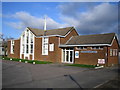
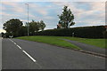
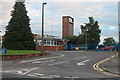
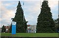
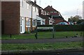
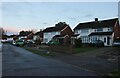
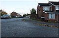
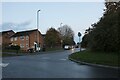
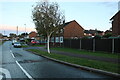
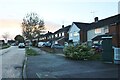
Photos of LU3 3BL


Area Information
Living in LU3 3BL means being part of a small, tightly knit residential cluster in England. The area covers 8,163 square metres and is home to 1,969 people, resulting in a high population density of 241,208 people per square kilometre. This compact postcode is characterised by its focus on housing, with the majority of properties being owner-occupied. The community is predominantly composed of adults aged 30–64, reflecting a mature demographic profile. Daily life here is shaped by proximity to essential services, including retail outlets, rail networks, and two major airports. While the area is small, it offers practical access to amenities that support both local and regional connectivity. For those seeking a balance between residential comfort and accessibility, LU3 3BL provides a compact environment with a clear emphasis on housing over commercial development. The median age of 47 suggests a stable, established community, though the high density may influence the pace of life.
- Area Type
- Postcode
- Area Size
- 8163 m²
- Population
- 1969
- Population Density
- 2533 people/km²
The property market in LU3 3BL is dominated by owner-occupied homes, with 65% of properties owned by residents rather than rented. This suggests a community of long-term residents rather than a transient rental market. The accommodation type is primarily houses, indicating a focus on single-family dwellings rather than apartments or terraced housing. Given the small area size of 8,163 square metres and the high population density, the housing stock is likely limited in scale. Buyers should consider the immediate surroundings, as the area itself is compact. The predominance of houses may appeal to those seeking traditional, private living spaces. However, the lack of detailed information on property prices or types means further local research would be necessary for a comprehensive assessment.
House Prices in LU3 3BL
Showing 3 properties
| Address | Type | Beds | Baths | Last Sale Price | Last Sale Date | |
|---|---|---|---|---|---|---|
| Building 22, Skf Works, Sundon Park Road, Luton, LU3 3BL | Industrial | - | - | - | - | |
| Block 15, Skf Works, Sundon Park Road, Luton, LU3 3BL | general_industrial | - | - | - | - | |
| Effluent Treatment Plant, Skf Works, Sundon Park Road, Luton, LU3 3BL | Industrial | - | - | - | - |
Energy Efficiency in LU3 3BL
Residents of LU3 3BL have access to a range of practical amenities within close reach. The area includes five retail outlets, such as Aldi Sundon, Tesco Sundon, and Lidl Houghton, offering everyday shopping convenience. Rail stations like Leagrave and Luton provide easy access to broader transport networks, while proximity to London Luton Airport enhances regional connectivity. Although the data does not mention parks or leisure facilities, the presence of retail and transport hubs suggests a focus on functional daily living. The compact nature of the area means that amenities are likely clustered, reducing travel times for essentials. This setup supports a lifestyle where convenience and accessibility are prioritised over expansive leisure options.
Amenities
Schools
The nearest school to LU3 3BL is Lealands High School, a primary school with a good Ofsted rating. This provides families with access to a well-regarded primary education within practical reach. The absence of secondary schools in the data suggests that parents may need to look beyond the immediate area for secondary education options. For families prioritising primary schooling, Lealands High School’s rating offers reassurance about the quality of education. However, the lack of secondary school information means potential buyers should investigate further to understand the full range of educational opportunities available. The presence of a primary school with a good rating is a positive factor for families considering LU3 3BL as a home.
| Rank | School | Type | Entry gender | Ages |
|---|
Explore more schools in this area
Go to Schools tabDemographics
The community in LU3 3BL is predominantly composed of adults aged 30–64, with a median age of 47. This indicates a mature population, likely with established careers and families. Home ownership is high, at 65%, and the area is characterised by houses rather than flats or other forms of accommodation. The predominant ethnic group is White, though specific diversity statistics are not provided. The high population density of 241,208 people per square kilometre suggests a compact, possibly urbanised residential layout. While the data does not include deprivation metrics, the combination of high home ownership and a stable age profile implies a community with relatively stable economic conditions. However, the absence of detailed diversity or deprivation data means broader social dynamics remain unexplored.
Household Size
Accommodation Type
Tenure
Ethnic Group
Religion
Household Composition
Age
Household Deprivation
NS-SEC
Explore more demographic insights in this area
Go to Demographics tabPlanning
Planning Constraints
- Flood RiskPremium
- Ramsar Wetland SitesPremium
- Area of Outstanding Natural BeautyPremium
- Protected Nature ReservePremium
- Protected WoodlandPremium