Area Overview for LU3 2UZ
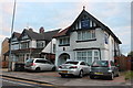
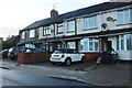
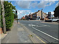
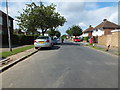
Photos of LU3 2UZ


Area Information
LU3 2UZ is a small, residential postcode area in England, home to 2,634 people. Its compact size fosters a tight-knit community, with a mix of families and professionals drawn to its practical amenities and connectivity. The area’s proximity to Luton and its surrounding infrastructure makes it a convenient base for commuters and those needing access to major transport links. Daily life here balances suburban tranquillity with urban accessibility, supported by nearby retail hubs, schools, and rail networks. The presence of multiple primary schools, including Norton Road Primary School and St Joseph’s Catholic Primary School, both rated ‘good’ by Ofsted, underscores its appeal to families. While the area lacks natural reserves or protected landscapes, its safety profile and digital connectivity make it a pragmatic choice for those prioritising security and modern convenience. Living in LU3 2UZ means navigating a small, manageable cluster of homes with clear access to essential services, making it suitable for those seeking a stable, low-risk environment.
- Area Type
- Postcode
- Area Size
- Not available
- Population
- 2634
- Population Density
- 8495 people/km²
The property market in LU3 2UZ is characterised by a 47% home ownership rate, meaning nearly half of the area’s housing stock is owner-occupied, while the remainder is likely rented. The accommodation type is predominantly houses, which aligns with the area’s suburban feel and appeal to families. This mix suggests a market that caters to both long-term residents seeking stability and renters looking for practical, family-friendly homes. The small size of the postcode area means properties are concentrated in a limited geographic footprint, potentially limiting availability for buyers. However, the proximity to Luton’s rail network and retail hubs adds value, making it a viable option for those prioritising accessibility over expansive living spaces. Buyers should consider the balance between home ownership and rental options, as well as the need for proximity to schools and transport links.
House Prices in LU3 2UZ
No properties found in this postcode.
Energy Efficiency in LU3 2UZ
Residents of LU3 2UZ benefit from a range of nearby amenities, including five retail outlets such as Iceland Luton, Lidl Leagrave, and Tesco Limbury, which provide everyday shopping needs. The area’s rail network, with stations like Leagrave and Luton Airport Parkway, offers seamless access to London and regional destinations, while London Luton Airport is within reach for international travel. Though the data does not specify parks or leisure facilities, the presence of multiple retail and transport hubs suggests a focus on practicality over extensive recreational spaces. The proximity to schools and shops creates a self-contained environment where daily essentials are easily accessible, reducing the need for long trips. This balance of convenience and connectivity supports a lifestyle that prioritises efficiency and accessibility.
Amenities
Schools
Residents of LU3 2UZ have access to a range of primary schools, including Norton Road Primary School and St Joseph’s Catholic Primary School, both of which hold ‘good’ Ofsted ratings. St Joseph’s RC Infant School also serves the area, though its rating is not specified. For children with special educational needs, Focus School provides tailored support, while independent education is available at Acorn Preparatory School. This diversity of school types ensures families can choose between state-funded, faith-based, and private options. The presence of multiple primary schools within practical reach reduces the need for long commutes, supporting a family-friendly lifestyle. The ‘good’ ratings at Norton Road and St Joseph’s Catholic suggest a solid foundation for academic development, though parents may need to consider additional factors such as school capacity and catchment areas.
| Rank | School | Type | Entry gender | Ages |
|---|
Explore more schools in this area
Go to Schools tabDemographics
The population of LU3 2UZ has a median age of 47, with the majority of residents aged between 30 and 64. This suggests a community of established professionals and families, rather than a transient population. Home ownership stands at 47%, indicating a mix of owner-occupied properties and rental units. The predominant accommodation type is houses, reflecting a preference for single-family homes over flats or apartments. The area’s predominant ethnic group is Asian, which shapes its cultural landscape and community dynamics. While no specific deprivation data is provided, the age profile and home ownership rate suggest a relatively stable demographic with moderate economic activity. The presence of multiple primary schools and retail amenities further supports a family-oriented environment, where access to services is prioritised over urban density.
Household Size
Accommodation Type
Tenure
Ethnic Group
Religion
Household Composition
Age
Household Deprivation
NS-SEC
Explore more demographic insights in this area
Go to Demographics tabPlanning
Planning Constraints
- Flood RiskPremium
- Ramsar Wetland SitesPremium
- Area of Outstanding Natural BeautyPremium
- Protected Nature ReservePremium
- Protected WoodlandPremium