Area Overview for LU3 2PF
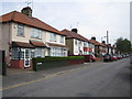
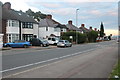
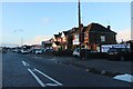
Photos of LU3 2PF


Area Information
LU3 2PF is a small residential postcode area in England, home to 2,634 residents. It occupies a compact cluster of homes, offering a quiet, community-focused environment. The area’s proximity to Luton and its surrounding infrastructure makes it accessible to urban amenities while retaining a distinct local character. Daily life here is shaped by its modest size and the presence of nearby schools, transport links, and retail hubs. Residents benefit from a mix of practical services, including multiple railway stations and proximity to London Luton Airport. The area’s demographic profile suggests a mature population, with adults aged 30–64 forming the largest group. This creates a stable, family-oriented atmosphere, supported by a range of primary schools and low crime rates. For those seeking a balanced lifestyle with convenience and safety, LU3 2PF offers a blend of residential comfort and practical connectivity.
- Area Type
- Postcode
- Area Size
- Not available
- Population
- 2634
- Population Density
- 8495 people/km²
In LU3 2PF, 47% of homes are owner-occupied, with houses forming the majority of the accommodation stock. This suggests a community where many residents have long-term ties to the area, though the remaining 53% may be rented, potentially attracting younger professionals or families seeking flexibility. The focus on houses rather than flats or apartments indicates a preference for private, family-oriented living spaces. Given the area’s small size, property availability is limited, which may influence prices and competition for homes. Buyers should consider the local market’s stability, supported by low crime rates and proximity to essential services. The mix of ownership and rental options offers both security and adaptability for those entering or expanding their housing needs in this small postcode cluster.
House Prices in LU3 2PF
No properties found in this postcode.
Energy Efficiency in LU3 2PF
Living in LU3 2PF offers access to essential amenities within practical reach. Retail options include Lidl Leagrave, Iceland Luton, and Tesco Luton, providing everyday shopping needs. The area’s rail network, with stations like Leagrave and Luton Airport Parkway, ensures easy travel to nearby towns and the airport. The presence of London Luton Airport nearby adds convenience for frequent travellers. While parks and leisure facilities are not explicitly listed, the area’s low crime rate and family-friendly schools suggest a focus on community living. The mix of retail, transport, and proximity to major infrastructure creates a lifestyle that balances convenience with a sense of local cohesion.
Amenities
Schools
LU3 2PF is served by several primary schools, including Norton Road Primary School and St Joseph’s Catholic Primary School, both rated ‘good’ by Ofsted. St Joseph’s RC Infant School also caters to younger children, while Focus School provides special education and Acorn Preparatory School offers independent schooling. This variety ensures families have options for different educational needs, from mainstream to specialist provision. The presence of multiple primary schools within reach supports a strong local education network, reducing the need for long commutes. For parents prioritising school quality, the ‘good’ ratings of two state schools and the availability of independent alternatives create a well-rounded choice. The area’s schools reflect a commitment to education accessibility, catering to diverse family requirements.
| Rank | School | Type | Entry gender | Ages |
|---|
Explore more schools in this area
Go to Schools tabDemographics
The population of LU3 2PF is 2,634, with a median age of 47, indicating a predominantly adult community. The largest age group is those aged 30–64, suggesting a mature, settled population. Home ownership sits at 47%, with houses being the primary accommodation type. This implies a mix of owner-occupied properties and rental options, though the exact proportion of rentals is not specified. The predominant ethnic group is Asian, reflecting the area’s cultural diversity. While no specific deprivation data is provided, the low crime risk score of 71 (below average) suggests a generally stable environment. This demographic profile supports a community focused on long-term living, with families and professionals coexisting in a setting that prioritises safety and accessibility.
Household Size
Accommodation Type
Tenure
Ethnic Group
Religion
Household Composition
Age
Household Deprivation
NS-SEC
Explore more demographic insights in this area
Go to Demographics tabPlanning
Planning Constraints
- Flood RiskPremium
- Ramsar Wetland SitesPremium
- Area of Outstanding Natural BeautyPremium
- Protected Nature ReservePremium
- Protected WoodlandPremium