Area Overview for LU3 2EW
Photos of LU3 2EW
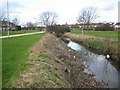
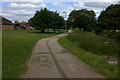
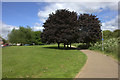
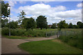
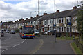
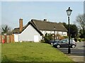
9 photos from this area
Area Information
Key information about the LU3 2EW including its size, population, and administrative classification.
- Area Type
- Postcode
- Area Size
- 7304 m²
- Population
- 1615
- Population Density
- 4204 people/km²
House Prices in LU3 2EW
19
Properties
£223,405
Average Sold Price
£34,450
Lowest Price
£385,000
Highest Price
Showing 19 properties
| Address | Type | Beds | Baths | Last Sale Price | Last Sale Date | |
|---|---|---|---|---|---|---|
| 32 Parys Road, Luton, LU3 2EW | Semi-detached | 3 | 1 | £385,000 | Jan 2023 | |
| 44 Parys Road, Luton, LU3 2EW | house | - | - | £320,000 | Jun 2021 | |
| 46 Parys Road, Luton, LU3 2EW | house | - | - | £348,000 | Jun 2021 | |
| 40 Parys Road, Luton, LU3 2EW | Semi-detached | 3 | 1 | £305,000 | Jun 2020 | |
| 25 Parys Road, Luton, LU3 2EW | Semi-detached | 3 | 1 | £215,000 | Mar 2018 | |
| 42 Parys Road, Luton, LU3 2EW | Semi-detached | 3 | 1 | £260,000 | Feb 2017 | |
| 35 Parys Road, Luton, LU3 2EW | house | - | - | £187,000 | Nov 2007 | |
| 36 Parys Road, Luton, LU3 2EW | house | - | - | £152,000 | Jun 2004 | |
| 34 Parys Road, Luton, LU3 2EW | Semi-detached | - | - | £140,000 | Feb 2003 | |
| 31 Parys Road, Luton, LU3 2EW | Terraced | - | - | £111,000 | Nov 2002 |
Page 1 of 2
Energy Efficiency in LU3 2EW
Amenities
Schools
| Rank | School | Type | Entry gender | Ages |
|---|
Explore more schools in this area
Go to Schools tabDemographics
Household Size
Family (3-5 people)
most common
Accommodation Type
Houses
most common
Tenure
78
majority
Ethnic Group
White
most common
Religion
N/A
most common
Household Composition
N/A
most common
Age
47
median
Adults (30-64 years)
most common
Household Deprivation
N/A
with no deprivation
NS-SEC
27
in Lower managerial occupations
Explore more demographic insights in this area
Go to Demographics tabPlanning
Planning Constraints
- Flood RiskPremium
- Ramsar Wetland SitesPremium
- Area of Outstanding Natural BeautyPremium
- Protected Nature ReservePremium
- Protected WoodlandPremium