Area Overview for LU3 2EH
Photos of LU3 2EH
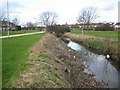
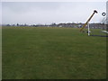
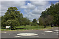
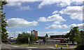
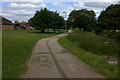
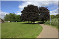
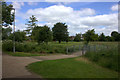
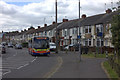
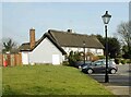
9 photos from this area
Area Information
Key information about the LU3 2EH including its size, population, and administrative classification.
- Area Type
- Postcode
- Area Size
- 1.7 hectares
- Population
- 1737
- Population Density
- 7484 people/km²
House Prices in LU3 2EH
46
Properties
£150,925
Average Sold Price
£47,500
Lowest Price
£286,500
Highest Price
Showing 46 properties
| Address | Type | Beds | Baths | Last Sale Price | Last Sale Date | |
|---|---|---|---|---|---|---|
| 31 Runfold Avenue, Luton, LU3 2EH | Terraced | 3 | 1 | £286,500 | Oct 2022 | |
| 30 Runfold Avenue, Luton, LU3 2EH | Terraced | 3 | 1 | £217,000 | Feb 2021 | |
| 24 Runfold Avenue, Luton, LU3 2EH | Semi-detached | 3 | 1 | £210,000 | Nov 2019 | |
| 27 Runfold Avenue, Luton, LU3 2EH | Terraced | 3 | 1 | £250,000 | Sep 2019 | |
| 34 Runfold Avenue, Luton, LU3 2EH | Terraced | 3 | 3 | £217,000 | Jun 2016 | |
| 12 Runfold Avenue, Luton, LU3 2EH | Terraced | 3 | 1 | £215,000 | Mar 2016 | |
| 7 Runfold Avenue, Luton, LU3 2EH | Terraced | 3 | - | £187,000 | Dec 2015 | |
| 45 Runfold Avenue, Luton, LU3 2EH | house | - | - | £240,000 | Sep 2015 | |
| 4 Runfold Avenue, Luton, LU3 2EH | Semi-detached | 3 | - | £165,000 | Jan 2015 | |
| 16 Runfold Avenue, Luton, LU3 2EH | Terraced | 3 | 1 | £164,000 | Nov 2014 |
Page 1 of 5
Energy Efficiency in LU3 2EH
Amenities
Schools
| Rank | School | Type | Entry gender | Ages |
|---|
Explore more schools in this area
Go to Schools tabDemographics
Household Size
Family (3-5 people)
most common
Accommodation Type
Houses
most common
Tenure
74
majority
Ethnic Group
asian_total
most common
Religion
N/A
most common
Household Composition
N/A
most common
Age
47
median
Adults (30-64 years)
most common
Household Deprivation
N/A
with no deprivation
NS-SEC
26
in Lower managerial occupations
Explore more demographic insights in this area
Go to Demographics tabPlanning
Planning Constraints
- Flood RiskPremium
- Ramsar Wetland SitesPremium
- Area of Outstanding Natural BeautyPremium
- Protected Nature ReservePremium
- Protected WoodlandPremium