Area Overview for LU3 1NZ
Photos of LU3 1NZ
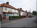
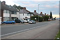
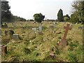
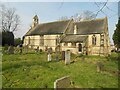

7 photos from this area
Area Information
Key information about the LU3 1NZ including its size, population, and administrative classification.
- Area Type
- Postcode
- Area Size
- 4587 m²
- Population
- 2398
- Population Density
- 10354 people/km²
House Prices in LU3 1NZ
13
Properties
£215,278
Average Sold Price
£50,000
Lowest Price
£410,000
Highest Price
Showing 13 properties
| Address | Type | Beds | Baths | Last Sale Price | Last Sale Date | |
|---|---|---|---|---|---|---|
| 23 Bishopscote Road, Luton, LU3 1NZ | Detached | 4 | 2 | £410,000 | Mar 2025 | |
| 37 Bishopscote Road, Luton, LU3 1NZ | Terraced | 3 | 2 | £360,000 | Dec 2024 | |
| 35 Bishopscote Road, Luton, LU3 1NZ | Terraced | 5 | 2 | £360,000 | Jun 2021 | |
| 21 Bishopscote Road, Luton, LU3 1NZ | house | - | - | £192,500 | Jun 2013 | |
| 17 Bishopscote Road, Luton, LU3 1NZ | Detached | 1 | 1 | £185,000 | Jan 2013 | |
| 41 Bishopscote Road, Luton, LU3 1NZ | house | - | - | £169,000 | Dec 2006 | |
| 31 Bishopscote Road, Luton, LU3 1NZ | house | 3 | - | £160,000 | Sep 2004 | |
| 33 Bishopscote Road, Luton, LU3 1NZ | house | - | - | £51,000 | Nov 1998 | |
| 43 Bishopscote Road, Luton, LU3 1NZ | Semi-detached | 4 | 2 | £50,000 | Sep 1998 | |
| 39 Bishopscote Road, Luton, LU3 1NZ | Terraced | - | - | - | - |
Page 1 of 2
Energy Efficiency in LU3 1NZ
Amenities
Schools
| Rank | School | Type | Entry gender | Ages |
|---|
Explore more schools in this area
Go to Schools tabDemographics
Household Size
Family (3-5 people)
most common
Accommodation Type
Houses
most common
Tenure
61
majority
Ethnic Group
asian_total
most common
Religion
N/A
most common
Household Composition
N/A
most common
Age
47
median
Adults (30-64 years)
most common
Household Deprivation
N/A
with no deprivation
NS-SEC
19
in Lower managerial occupations
Explore more demographic insights in this area
Go to Demographics tabPlanning
Planning Constraints
- Flood RiskPremium
- Ramsar Wetland SitesPremium
- Area of Outstanding Natural BeautyPremium
- Protected Nature ReservePremium
- Protected WoodlandPremium