Area Overview for LU2 9UX
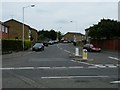
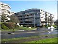
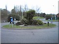
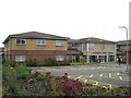
Photos of LU2 9UX


Area Information
LU2 9UX is a small, tightly packed residential postcode in England, home to 1,439 residents spread over a compact area. With a population density of 598 people per square kilometre, it’s a community where proximity to neighbours is almost inevitable. This area leans heavily on its practicality, with a mix of housing stock and strategic transport links that cater to both daily needs and broader mobility. The median age of 47 suggests a mature, stable population, predominantly adults aged 30–64, many of whom own their homes. Living here means being within reach of Luton’s infrastructure, including two major airports and multiple rail stations. While the area lacks natural attractions like AONB or protected woodlands, its strength lies in accessibility and simplicity. Residents benefit from excellent broadband connectivity, with a score of 98, ensuring seamless online activity. However, the high crime risk score of 1/100 is a notable concern, requiring vigilance. For those prioritising convenience over scenic landscapes, LU2 9UX offers a straightforward, no-frills lifestyle.
- Area Type
- Postcode
- Area Size
- Not available
- Population
- 1439
- Population Density
- 598 people/km²
LU2 9UX is a predominantly owner-occupied area, with 62% of homes owned by residents rather than rented. The accommodation type is primarily houses, which is unusual for a small postcode but may indicate a mix of semi-detached or terraced properties. This suggests a housing stock tailored to families or individuals seeking more space than typical flats. Given the area’s compact size, the property market is likely limited to the immediate vicinity, with buyers needing to consider nearby postcodes for additional options. The high home ownership rate implies a stable market, potentially with lower turnover. However, the lack of detailed data on property prices or availability means buyers should investigate surrounding areas for broader choices. The focus on houses also means the area may appeal to those prioritising privacy and space over urban density.
House Prices in LU2 9UX
No properties found in this postcode.
Energy Efficiency in LU2 9UX
Residents of LU2 9UX have access to a range of practical amenities within reach. The retail sector includes Asda Luton, Iceland Luton, and Spar, providing everyday shopping options for groceries and household items. The proximity to London Luton Airport offers easy travel for both leisure and business, while nearby rail stations like Luton Airport Parkway and Leagrave provide connections to other parts of the country. Although the area lacks parks or leisure facilities, the presence of multiple retail outlets and transport hubs suggests a lifestyle focused on convenience and accessibility. The limited number of amenities means residents may need to travel further for dining or entertainment, but the area’s strength lies in its straightforward, functional approach to daily living. The combination of retail, transport, and airport access ensures that most needs are met without significant effort.
Amenities
Schools
The nearest school to LU2 9UX is Wigmore Primary, a primary school with a Good Ofsted rating. This single school serves the area’s children, though the absence of secondary schools or other educational institutions means families may need to travel further for secondary education. The presence of a well-rated primary school is a key consideration for families, as it ensures a foundation of quality early education. However, the limited range of schools suggests that parents should factor in commuting time for older children. The data does not indicate additional schools, so the educational landscape is narrowly focused on primary-level provision. For those prioritising proximity to schools, Wigmore Primary’s Good rating is a positive, but the lack of secondary options may require planning.
| Rank | School | Type | Entry gender | Ages |
|---|
Explore more schools in this area
Go to Schools tabDemographics
The population of LU2 9UX is predominantly adults aged 30–64, reflecting a mature demographic with a median age of 47. Home ownership is strong, with 62% of residents living in owner-occupied properties, suggesting a stable, long-term community. The accommodation type is primarily houses, which is uncommon in densely populated areas, indicating a mix of single-family homes and possibly semi-detached properties. The predominant ethnic group is White, though the data does not specify further diversity metrics. With a population density of 598 people per square kilometre, the area is neither sprawling nor sparse, fostering a sense of closeness. However, the absence of detailed deprivation data means it’s unclear how economic factors influence daily life. The demographic profile suggests a community focused on practical living, with a strong emphasis on home ownership and a population that has likely settled in the area for the long term.
Household Size
Accommodation Type
Tenure
Ethnic Group
Religion
Household Composition
Age
Household Deprivation
NS-SEC
Explore more demographic insights in this area
Go to Demographics tabPlanning
Planning Constraints
- Flood RiskPremium
- Ramsar Wetland SitesPremium
- Area of Outstanding Natural BeautyPremium
- Protected Nature ReservePremium
- Protected WoodlandPremium