Area Overview for LU2 9TD
Photos of LU2 9TD
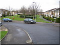

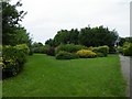
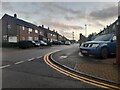
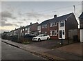
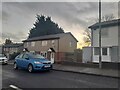
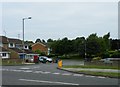
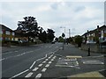
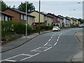
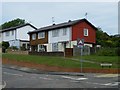
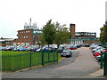
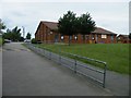
23 photos from this area
Area Information
Key information about the LU2 9TD including its size, population, and administrative classification.
- Area Type
- Postcode
- Area Size
- 1.0 hectares
- Population
- 1445
- Population Density
- 719 people/km²
House Prices in LU2 9TD
39
Properties
£152,684
Average Sold Price
£35,000
Lowest Price
£285,000
Highest Price
Showing 39 properties
| Address | Type | Beds | Baths | Last Sale Price | Last Sale Date | |
|---|---|---|---|---|---|---|
| 16 Felton Close, Luton, LU2 9TD | house | 2 | 1 | £285,000 | Jun 2025 | |
| 1 Felton Close, Luton, LU2 9TD | Semi-detached | 1 | 1 | £231,000 | Mar 2025 | |
| 27 Felton Close, Luton, LU2 9TD | Maisonette | 1 | 1 | £105,000 | Oct 2023 | |
| 15 Felton Close, Luton, LU2 9TD | Semi-detached | 2 | 1 | £257,000 | May 2023 | |
| 13 Felton Close, Luton, LU2 9TD | Detached | 2 | 1 | £250,000 | Sep 2022 | |
| 5 Felton Close, Luton, LU2 9TD | house | 2 | 1 | £270,000 | Sep 2022 | |
| 30 Felton Close, Luton, LU2 9TD | Maisonette | - | - | £163,000 | Jun 2022 | |
| 24 Felton Close, Luton, LU2 9TD | Maisonette | 1 | - | £173,000 | Dec 2021 | |
| 22 Felton Close, Luton, LU2 9TD | Flat | 1 | 1 | £179,995 | Sep 2021 | |
| 17 Felton Close, Luton, LU2 9TD | Semi-detached | 2 | 1 | £250,000 | Nov 2019 |
Page 1 of 4
Energy Efficiency in LU2 9TD
Amenities
Schools
| Rank | School | Type | Entry gender | Ages |
|---|
Explore more schools in this area
Go to Schools tabDemographics
Household Size
Family (3-5 people)
most common
Accommodation Type
Houses
most common
Tenure
76
majority
Ethnic Group
White
most common
Religion
N/A
most common
Household Composition
N/A
most common
Age
47
median
Adults (30-64 years)
most common
Household Deprivation
N/A
with no deprivation
NS-SEC
33
in Lower managerial occupations
Explore more demographic insights in this area
Go to Demographics tabPlanning
Planning Constraints
- Flood RiskPremium
- Ramsar Wetland SitesPremium
- Area of Outstanding Natural BeautyPremium
- Protected Nature ReservePremium
- Protected WoodlandPremium