Area Overview for LU2 9NF
Photos of LU2 9NF


Area Information
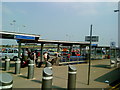
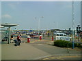
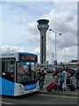
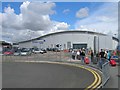
LU2 9NF is a compact residential postcode in England, home to 1,445 people spread across a densely populated area. With 719 people per square kilometre, it’s a tightly knit cluster of homes, predominantly owner-occupied. The area sits near London Luton Airport, offering easy access to travel and nearby railway stations like Luton Airport Parkway and Luton itself. This proximity to transport hubs makes it appealing for commuters, while the high broadband score of 100 ensures seamless digital connectivity. Daily life here balances suburban convenience with practicality—retail options include major chains like Tesco and Asda, and the local rail network provides links to surrounding towns. The population’s median age of 47 suggests a mature community, with many residents in their 30s to 60s. While the area lacks natural beauty designations, its strategic location and infrastructure make it a functional choice for those prioritising connectivity and accessibility.
- Area Type
- Postcode
- Area Size
- Not available
- Population
- 1445
- Population Density
- 719 people/km²
The property market in LU2 9NF is dominated by owner-occupied homes, with 76% of residents living in their own properties. This suggests a stable, low-turnover market where long-term residency is common. The accommodation type is primarily houses, which may appeal to families or those seeking more space than flats. Given the area’s small size, the housing stock is limited, making it a niche market for buyers seeking specific properties. The high home ownership rate also implies that rental availability is likely constrained, potentially increasing competition for available units. For buyers, this means a focus on existing homes rather than new developments, with properties likely to be in good condition due to the age of the population. The proximity to transport links may also influence property values, as accessibility to Luton Airport and rail networks adds practical appeal.
House Prices in LU2 9NF
No properties found in this postcode.
Energy Efficiency in LU2 9NF
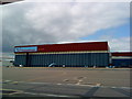
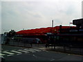
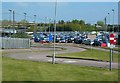
Living in LU2 9NF offers a blend of practical retail and transport hubs. The area is served by five notable retail outlets, including M&S Luton Airport SF, Tesco Luton, and Asda Luton, ensuring everyday shopping needs are met. Proximity to London Luton Airport provides easy access to national and international travel, while the four nearby railway stations—Luton Airport Parkway, Luton, and Leagrave—offer efficient links to London and other destinations. Though the area lacks parks or leisure facilities within its immediate boundaries, its strategic location means residents can access broader amenities in nearby towns. The presence of major retailers and transport links contributes to a convenient, functional lifestyle, particularly for those prioritising accessibility over natural surroundings.
Amenities
Schools
| Rank | School | Type | Entry gender | Ages |
|---|
Explore more schools in this area
Go to Schools tabDemographics
The community in LU2 9NF is predominantly composed of adults aged 30 to 64, with a median age of 47. This suggests a stable, mature population, likely with established careers and families. Home ownership is high at 76%, indicating a strong presence of long-term residents. The accommodation type is primarily houses, which aligns with the area’s residential character. The predominant ethnic group is White, reflecting a homogenous demographic profile. While no specific data on deprivation is provided, the high home ownership rate and median age suggest a relatively stable economic environment. However, the lack of detailed diversity metrics means the community’s full composition remains less defined. The compact nature of the area, combined with its transport links, likely supports a mix of local professionals and commuters.
Household Size
Accommodation Type
Tenure
Ethnic Group
Religion
Household Composition
Age
Household Deprivation
NS-SEC
Explore more demographic insights in this area
Go to Demographics tabPlanning
Planning Constraints
- Flood RiskPremium
- Ramsar Wetland SitesPremium
- Area of Outstanding Natural BeautyPremium
- Protected Nature ReservePremium
- Protected WoodlandPremium