Area Overview for LU2 9AH
Photos of LU2 9AH

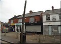
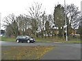
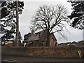
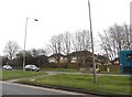
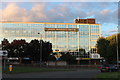

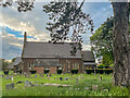
34 photos from this area
Area Information
Key information about the LU2 9AH including its size, population, and administrative classification.
- Area Type
- Postcode
- Area Size
- 2.7 hectares
- Population
- 1993
- Population Density
- 5538 people/km²
House Prices in LU2 9AH
45
Properties
£217,522
Average Sold Price
£60,000
Lowest Price
£420,000
Highest Price
Showing 45 properties
| Address | Type | Beds | Baths | Last Sale Price | Last Sale Date | |
|---|---|---|---|---|---|---|
| 245 Turners Road North, Luton, LU2 9AH | Semi-detached | 3 | 1 | £340,000 | Oct 2025 | |
| 154 Turners Road North, Luton, LU2 9AH | Bungalow | 2 | 2 | £375,000 | May 2024 | |
| 146 Turners Road North, Luton, LU2 9AH | Bungalow | 3 | 1 | £365,000 | Feb 2024 | |
| 233 Turners Road North, Luton, LU2 9AH | Detached | 3 | 1 | £260,000 | Aug 2023 | |
| 203 Turners Road North, Luton, LU2 9AH | Semi-detached | 5 | 3 | £420,000 | Apr 2023 | |
| 243 Turners Road North, Luton, LU2 9AH | house | - | - | £325,000 | Sep 2022 | |
| 134 Turners Road North, Luton, LU2 9AH | Bungalow | 3 | 1 | £260,000 | Sep 2020 | |
| 150 Turners Road North, Luton, LU2 9AH | Bungalow | - | - | £240,000 | Mar 2019 | |
| 156 Turners Road North, Luton, LU2 9AH | house | - | - | £245,000 | Jan 2019 | |
| 116 Turners Road North, Luton, LU2 9AH | Detached | 3 | 1 | £380,000 | Nov 2018 |
Page 1 of 5
Energy Efficiency in LU2 9AH
Amenities
Schools
| Rank | School | Type | Entry gender | Ages |
|---|
Explore more schools in this area
Go to Schools tabDemographics
Household Size
Family (3-5 people)
most common
Accommodation Type
Houses
most common
Tenure
65
majority
Ethnic Group
White
most common
Religion
N/A
most common
Household Composition
N/A
most common
Age
47
median
Adults (30-64 years)
most common
Household Deprivation
N/A
with no deprivation
NS-SEC
24
in Lower managerial occupations
Explore more demographic insights in this area
Go to Demographics tabPlanning
Planning Constraints
- Flood RiskPremium
- Ramsar Wetland SitesPremium
- Area of Outstanding Natural BeautyPremium
- Protected Nature ReservePremium
- Protected WoodlandPremium