Area Overview for LU2 8NF
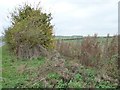
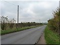
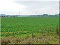
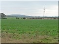
Photos of LU2 8NF
Area Information
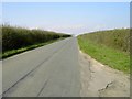
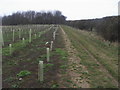
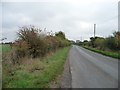
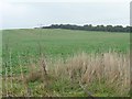
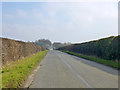
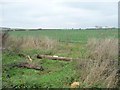
LU2 8NF is a small, tightly knit residential area in England, covering 96.3 hectares and home to 1,660 people. With a population density of 200 people per square kilometre, it strikes a balance between privacy and community. The area is characterised by its predominantly residential nature, with homes making up the majority of accommodation. Residents here are largely adults aged 30–64, with a median age of 47, reflecting a mature, stable demographic. Daily life in LU2 8NF is shaped by its proximity to essential services, including schools, retail outlets, and transport links. The area’s low crime risk—scoring 89 out of 100 for safety—adds to its appeal, while its designation within an Area of Outstanding Natural Beauty offers residents access to scenic landscapes. Though small, LU2 8NF is well-connected, with nearby railway stations and proximity to London Luton Airport. This makes it a practical choice for those seeking a quiet, family-friendly environment without being isolated from urban amenities.
- Area Type
- Postcode
- Area Size
- 96.3 hectares
- Population
- 1660
- Population Density
- 200 people/km²
The property market in LU2 8NF is dominated by owner-occupied homes, with 81% of residents living in properties they own. This high rate of home ownership suggests a stable, long-term community with limited rental activity. The accommodation type is primarily houses, which is unusual for areas with high population density but aligns with LU2 8NF’s small, residential character. Given the area’s size—just 96.3 hectares—buyers should expect a limited number of properties, making it a niche market. The focus on owner-occupied housing means competition for available homes may be keen, particularly for those seeking family-friendly properties. The predominance of houses over flats or apartments also implies a preference for larger, more private living spaces, which could appeal to buyers prioritising space and privacy.
House Prices in LU2 8NF
Showing 1 properties
| Address | Type | Beds | Baths | Last Sale Price | Last Sale Date | |
|---|---|---|---|---|---|---|
| Barton Hill Farm, Barton Hill Road, Streatley, LU2 8NF | Detached | - | - | - | - |
Energy Efficiency in LU2 8NF
The lifestyle in LU2 8NF is shaped by its practical amenities, which cater to daily needs without requiring long journeys. Retail options include Morrisons Daily Barton-Le, Co-op Barton le, and Aldi Bramingham, providing grocery and household essentials. The area’s rail network, with stations like Leagrave and Luton, connects residents to broader transport routes, while London Luton Airport offers international travel convenience. Though the data does not specify parks or leisure facilities, the inclusion of an Area of Outstanding Natural Beauty nearby suggests opportunities for outdoor activities. The presence of multiple schools and shops within walking or short driving distance reinforces the area’s appeal for families seeking a self-contained, low-stress environment. This balance of practicality and accessibility makes LU2 8NF suitable for those prioritising ease of living over sprawling urban amenities.
Amenities
Schools
Residents of LU2 8NF have access to a range of educational institutions, including primary and academy schools. Ramsey Manor Lower School and Arnold Middle School both offer primary education, while Arnold Academy and Ramsey Manor Lower School (now an academy) provide secondary-level schooling. Arnold Academy holds an Ofsted rating of ‘good’, indicating a reliable standard of education. The mix of primary and academy schools gives families flexibility, whether they prioritise traditional schooling or institutions with specialist curricula. The presence of multiple schools within practical reach suggests the area is well-suited for families with children, reducing the need for long commutes. However, the absence of data on school catchment areas or pupil numbers means prospective buyers should verify admissions policies directly with the schools.
| Rank | School | Type | Entry gender | Ages |
|---|
Explore more schools in this area
Go to Schools tabDemographics
The community in LU2 8NF is predominantly composed of adults aged 30–64, with a median age of 47. This suggests a population that is largely settled, with strong ties to the area. Home ownership is high, at 81%, indicating a stable housing market and long-term residency. The accommodation type is primarily houses, which aligns with the area’s residential character. The predominant ethnic group is White, reflecting a homogenous demographic profile. With no specific data on deprivation or diversity beyond this, the area appears to cater to a consistent, middle-aged population. The low population density of 200 people per square kilometre further supports the idea of a low-pressure, community-oriented environment. This demographic structure likely influences local services and amenities, which are tailored to the needs of families and long-term residents rather than transient populations.
Household Size
Accommodation Type
Tenure
Ethnic Group
Religion
Household Composition
Age
Household Deprivation
NS-SEC
Explore more demographic insights in this area
Go to Demographics tabPlanning
Planning Constraints
- Flood RiskPremium
- Ramsar Wetland SitesPremium
- Area of Outstanding Natural BeautyPremium
- Protected Nature ReservePremium
- Protected WoodlandPremium