Area Overview for LU2 8DD
Photos of LU2 8DD
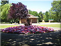
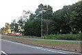
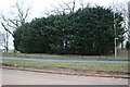
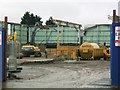
4 photos from this area
Area Information
Key information about the LU2 8DD including its size, population, and administrative classification.
- Area Type
- Postcode
- Area Size
- 14.8 hectares
- Population
- 1294
- Population Density
- 779 people/km²
House Prices in LU2 8DD
6
Properties
£523,500
Average Sold Price
£287,500
Lowest Price
£750,000
Highest Price
Showing 6 properties
| Address | Type | Beds | Baths | Last Sale Price | Last Sale Date | |
|---|---|---|---|---|---|---|
| The Jackdaws, 12 Butterfield Green Road, Luton, LU2 8DD | house | - | - | £750,000 | Mar 2023 | |
| The Thatched Cottage, 111 Butterfield Green Road, Luton, LU2 8DD | Detached | 4 | 4 | £700,000 | Mar 2021 | |
| Braeside, 8 Butterfield Green Road, Luton, LU2 8DD | house | 3 | - | £380,000 | Jan 2015 | |
| Foresbrook, 6 Butterfield Green Road, Luton, LU2 8DD | Detached | - | - | £499,999 | Dec 2010 | |
| 126 Butterfield Green Road, Luton, LU2 8DD | Detached | - | - | £287,500 | Jul 2008 | |
| The Vale Lodge, The Vale Cemetery, 2 Butterfield Green Road, Luton, LU2 8DD | Detached | - | - | - | - |
Energy Efficiency in LU2 8DD
Amenities
Schools
| Rank | School | Type | Entry gender | Ages |
|---|
Explore more schools in this area
Go to Schools tabDemographics
Household Size
Family (3-5 people)
most common
Accommodation Type
Houses
most common
Tenure
90
majority
Ethnic Group
White
most common
Religion
N/A
most common
Household Composition
N/A
most common
Age
47
median
Adults (30-64 years)
most common
Household Deprivation
N/A
with no deprivation
NS-SEC
38
in Lower managerial occupations
Explore more demographic insights in this area
Go to Demographics tabPlanning
Planning Constraints
- Flood RiskPremium
- Ramsar Wetland SitesPremium
- Area of Outstanding Natural BeautyPremium
- Protected Nature ReservePremium
- Protected WoodlandPremium