Area Overview for LU2 7XG
Photos of LU2 7XG


Area Information
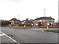
LU2 7XG is a small, tightly knit residential area in England, home to around 1,462 people. Its compact nature means it offers a quiet, community-focused environment, ideal for those seeking a balance between suburban comfort and practical connectivity. The area is characterised by a predominance of houses, reflecting a stable, long-term resident base. With a median age of 47, the population skews towards adults in their 30s to 60s, suggesting a mature, established community. Proximity to Luton Railway Station and London Luton Airport ensures easy access to regional and national travel, while nearby schools and retail hubs provide daily conveniences. The area’s low flood risk and absence of protected natural sites make it a straightforward place to live, though crime rates are above average. For buyers, LU2 7XG offers a blend of traditional housing, strong transport links, and proximity to essential services, though security considerations should be noted.
- Area Type
- Postcode
- Area Size
- Not available
- Population
- 1462
- Population Density
- 2159 people/km²
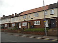
LU2 7XG is a largely owner-occupied area, with 75% of homes owned by residents rather than rented. The accommodation type is predominantly houses, which is unusual for areas with higher apartment or flat density. This suggests a market focused on single-family homes, appealing to those prioritising space and privacy. Given the small size of the postcode and its residential nature, the housing stock is likely limited, with properties being well-established. Buyers should consider the area’s compactness, which may mean limited scope for new developments. The high home ownership rate indicates a stable market, but the small size of the area means competition for properties could be fierce. For those seeking a traditional, family-friendly home, LU2 7XG offers a straightforward, low-risk investment.
House Prices in LU2 7XG
No properties found in this postcode.
Energy Efficiency in LU2 7XG
Daily life in LU2 7XG is shaped by its proximity to essential amenities. Residents can access multiple retail outlets, including Co-op Stopsley and Tesco Luton, for shopping and groceries. The area’s rail connections to Luton and Leagrave stations provide easy access to employment hubs and leisure destinations. London Luton Airport is within practical reach, offering travel flexibility. While the area lacks detailed information on parks or leisure facilities, the presence of schools and retail options suggests a focus on practicality over expansive recreational spaces. The compact size of LU2 7XG means amenities are concentrated, reducing the need for long commutes. This makes it convenient for those prioritising accessibility over sprawling green spaces.
Amenities
Schools
Residents of LU2 7XG have access to several schools, including Stopsley Community Primary School and Stopsley Infant School, both rated ‘good’ by Ofsted. Stopsley High School, listed as both a primary and academy, also serves the area, though its Ofsted rating is not specified. The presence of multiple primary schools suggests a focus on early education, while the academy model at Stopsley High School may offer specialised curricula or governance structures. Families have options for both traditional state-run and academically distinct institutions. The mix of school types allows parents to choose between established community schools or those with alternative educational approaches. However, the lack of secondary school data means further research is needed for older children.
| Rank | School | Type | Entry gender | Ages |
|---|
Explore more schools in this area
Go to Schools tabDemographics
The population of LU2 7XG is predominantly adults aged 30–64, with a median age of 47. This suggests a community of middle-aged individuals, likely with established careers and families. Home ownership is high at 75%, indicating a strong presence of long-term residents and a stable property market. The area is primarily composed of houses, reflecting a preference for private, family-oriented living. The predominant ethnic group is White, though specific data on diversity or deprivation is not provided. The age profile implies a mix of professionals and retirees, with fewer young families or students. This demographic structure may influence local services and amenities, aligning them with the needs of an older, more settled population.
Household Size
Accommodation Type
Tenure
Ethnic Group
Religion
Household Composition
Age
Household Deprivation
NS-SEC
Explore more demographic insights in this area
Go to Demographics tabPlanning
Planning Constraints
- Flood RiskPremium
- Ramsar Wetland SitesPremium
- Area of Outstanding Natural BeautyPremium
- Protected Nature ReservePremium
- Protected WoodlandPremium