Area Overview for LU2 7UP
Photos of LU2 7UP
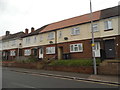
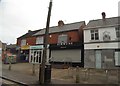
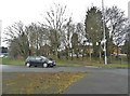
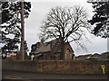
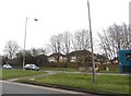
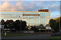
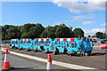
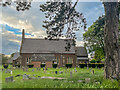
34 photos from this area
Area Information
Key information about the LU2 7UP including its size, population, and administrative classification.
- Area Type
- Postcode
- Area Size
- 1.0 hectares
- Population
- 1462
- Population Density
- 2159 people/km²
House Prices in LU2 7UP
15
Properties
£236,857
Average Sold Price
£60,000
Lowest Price
£330,000
Highest Price
Showing 15 properties
| Address | Type | Beds | Baths | Last Sale Price | Last Sale Date | |
|---|---|---|---|---|---|---|
| 647 Hitchin Road, Luton, LU2 7UP | Bungalow | - | - | £330,000 | Jul 2022 | |
| 645 Hitchin Road, Luton, LU2 7UP | house | - | - | £311,000 | Apr 2021 | |
| 633 Hitchin Road, Luton, LU2 7UP | Terraced | 2 | 1 | £210,000 | Sep 2017 | |
| 655 Hitchin Road, Luton, LU2 7UP | Detached | 3 | 2 | £290,000 | Jul 2017 | |
| 653 Hitchin Road, Luton, LU2 7UP | Semi-detached | 3 | 1 | £285,000 | Jun 2017 | |
| 651 Hitchin Road, Luton, LU2 7UP | Detached | 3 | 1 | £172,000 | Apr 2012 | |
| 635 Hitchin Road, Luton, LU2 7UP | Terraced | - | - | £60,000 | Dec 2000 | |
| 649 Hitchin Road, Luton, LU2 7UP | Bungalow | 3 | 1 | - | - | |
| 611B Hitchin Road, Luton, LU2 7UP | Flat | - | - | - | - | |
| 611A Hitchin Road, Luton, LU2 7UP | Flat | 3 | 1 | - | - |
Page 1 of 2
Energy Efficiency in LU2 7UP
Amenities
Schools
| Rank | School | Type | Entry gender | Ages |
|---|
Explore more schools in this area
Go to Schools tabDemographics
Household Size
One person
most common
Accommodation Type
Houses
most common
Tenure
75
majority
Ethnic Group
White
most common
Religion
N/A
most common
Household Composition
N/A
most common
Age
47
median
Adults (30-64 years)
most common
Household Deprivation
N/A
with no deprivation
NS-SEC
30
in Lower managerial occupations
Explore more demographic insights in this area
Go to Demographics tabPlanning
Planning Constraints
- Flood RiskPremium
- Ramsar Wetland SitesPremium
- Area of Outstanding Natural BeautyPremium
- Protected Nature ReservePremium
- Protected WoodlandPremium