Area Overview for LU2 7FB
Photos of LU2 7FB
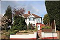
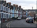
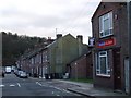
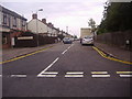
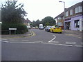
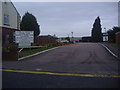
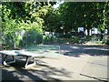
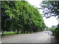
17 photos from this area
Area Information
Key information about the LU2 7FB including its size, population, and administrative classification.
- Area Type
- Postcode
- Area Size
- 3321 m²
- Population
- 2175
- Population Density
- 8809 people/km²
House Prices in LU2 7FB
43
Properties
£151,300
Average Sold Price
£65,000
Lowest Price
£330,000
Highest Price
Showing 43 properties
| Address | Type | Beds | Baths | Last Sale Price | Last Sale Date | |
|---|---|---|---|---|---|---|
| 32E Clarendon Road, Luton, LU2 7FB | Maisonette | 3 | 2 | £65,000 | Oct 2021 | |
| 40 Clarendon Road, Luton, LU2 7FB | house | - | - | £330,000 | May 2021 | |
| 32D Clarendon Road, Luton, LU2 7FB | Flat | - | - | £89,000 | Apr 2016 | |
| 38 Clarendon Road, Luton, LU2 7FB | house | 3 | - | £197,500 | Mar 2015 | |
| 32A Clarendon Road, Luton, LU2 7FB | Flat | - | - | £75,000 | May 2014 | |
| 32F Clarendon Road, Luton, LU2 7FB | Flat | - | - | - | - | |
| 35 Clarendon Road, Luton, LU2 7FB | Flat | 1 | - | - | - | |
| 33 CLARENDON ROAD, Luton, LU2 7FB | Semi-detached | 6 | 2 | - | - | |
| Blakedown, 50 Clarendon Road, Luton, LU2 7FB | undefined | - | - | - | - | |
| 35B Clarendon Road, Luton, LU2 7FB | Flat | 1 | 1 | - | - |
Page 1 of 5
Energy Efficiency in LU2 7FB
Amenities
Schools
| Rank | School | Type | Entry gender | Ages |
|---|
Explore more schools in this area
Go to Schools tabDemographics
Household Size
One person
most common
Accommodation Type
Flats
most common
Tenure
30
majority
Ethnic Group
White
most common
Religion
N/A
most common
Household Composition
N/A
most common
Age
47
median
Adults (30-64 years)
most common
Household Deprivation
N/A
with no deprivation
NS-SEC
23
in Lower managerial occupations
Explore more demographic insights in this area
Go to Demographics tabPlanning
Planning Constraints
- Flood RiskPremium
- Ramsar Wetland SitesPremium
- Area of Outstanding Natural BeautyPremium
- Protected Nature ReservePremium
- Protected WoodlandPremium