Area Overview for LU2 7DF
Photos of LU2 7DF
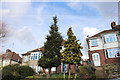
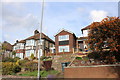
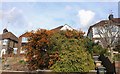
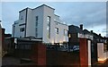

14 photos from this area
Area Information
Key information about the LU2 7DF including its size, population, and administrative classification.
- Area Type
- Postcode
- Area Size
- 4600 m²
- Population
- 1753
- Population Density
- 4585 people/km²
House Prices in LU2 7DF
11
Properties
£324,444
Average Sold Price
£207,550
Lowest Price
£405,000
Highest Price
Showing 11 properties
| Address | Type | Beds | Baths | Last Sale Price | Last Sale Date | |
|---|---|---|---|---|---|---|
| 246 Stockingstone Road, Luton, LU2 7DF | Semi-detached | 3 | 3 | £405,000 | Sep 2022 | |
| 256 Stockingstone Road, Luton, LU2 7DF | Semi-detached | 3 | 3 | £398,000 | Apr 2019 | |
| 260 Stockingstone Road, Luton, LU2 7DF | house | - | - | £400,000 | Apr 2018 | |
| 242 Stockingstone Road, Luton, LU2 7DF | Semi-detached | 4 | - | £375,000 | Feb 2015 | |
| 258 Stockingstone Road, Luton, LU2 7DF | Semi-detached | 4 | - | £285,000 | Oct 2009 | |
| 254 Stockingstone Road, Luton, LU2 7DF | house | - | - | £275,000 | Jul 2006 | |
| 240 Stockingstone Road, Luton, LU2 7DF | Detached | 4 | 1 | £250,000 | Feb 2005 | |
| 244 Stockingstone Road, Luton, LU2 7DF | Semi-detached | 3 | - | £207,550 | Oct 2002 | |
| 252 Stockingstone Road, Luton, LU2 7DF | Detached | 3 | - | - | - | |
| 248 Stockingstone Road, Luton, LU2 7DF | Semi-detached | - | - | - | - |
Page 1 of 2
Energy Efficiency in LU2 7DF
Amenities
Schools
| Rank | School | Type | Entry gender | Ages |
|---|
Explore more schools in this area
Go to Schools tabDemographics
Household Size
Family (3-5 people)
most common
Accommodation Type
Houses
most common
Tenure
91
majority
Ethnic Group
asian_total
most common
Religion
N/A
most common
Household Composition
N/A
most common
Age
47
median
Adults (30-64 years)
most common
Household Deprivation
N/A
with no deprivation
NS-SEC
42
in Lower managerial occupations
Explore more demographic insights in this area
Go to Demographics tabPlanning
Planning Constraints
- Flood RiskPremium
- Ramsar Wetland SitesPremium
- Area of Outstanding Natural BeautyPremium
- Protected Nature ReservePremium
- Protected WoodlandPremium