Area Overview for LU2 0XN
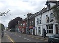
Photos of LU2 0XN


Area Information
LU2 0XN is a small residential postcode area in England, home to just 1,809 people. It is a compact cluster of properties, likely centred around a few key streets or developments. The area’s demographic profile suggests a mature community, with a median age of 47 and a majority of residents aged 30–64. This indicates a stable population, possibly with families or professionals in their mid-career. Daily life here is likely quiet and low-key, with no major urban hubs nearby but good access to transport links. The postcode sits near Luton Airport, which may influence local employment opportunities or commuting patterns. With no protected natural sites or flood risks, the area is free from environmental constraints that could complicate development or living. Its small size means the community is likely tight-knit, though the low home ownership rate (17%) suggests a higher proportion of renters. For those considering living in LU2 0XN, the balance of affordability, practical amenities, and proximity to transport could be appealing. However, the area’s limited size means it is not suited to those seeking sprawling landscapes or extensive retail options.
- Area Type
- Postcode
- Area Size
- Not available
- Population
- 1809
- Population Density
- 13705 people/km²
The property market in LU2 0XN is characterised by a low home ownership rate of 17%, indicating that the majority of housing stock is rented out rather than owner-occupied. This suggests the area may function more as a rental market than a place for long-term homeownership, possibly attracting tenants seeking affordability or those in temporary housing situations. The predominant accommodation type is flats, which aligns with the area’s small size and density. For buyers, this means the housing options are limited to a small number of flats, likely in multi-unit buildings. The low home ownership rate may also reflect limited demand for property purchase, potentially making it a less competitive market for buyers. However, the area’s proximity to transport links, such as Luton Railway Station and London Luton Airport, could make it attractive to those prioritising connectivity over property investment. Buyers should consider the limited availability of homes and the potential for a rental-focused market when exploring LU2 0XN.
House Prices in LU2 0XN
No properties found in this postcode.
Energy Efficiency in LU2 0XN
The lifestyle in LU2 0XN is shaped by its proximity to practical amenities, though the range is limited. Within reach are retail options such as Lidl Luton, Farmfoods Luton, and Lidl Bury, providing basic grocery needs. The area’s connection to London Luton Airport is a key feature, offering residents easy access to travel, which could be particularly valuable for those working in aviation, logistics, or frequent flyers. However, the data does not mention parks, dining venues, or leisure facilities, suggesting that recreational options are minimal. The absence of listed parks or cultural amenities means residents may need to travel further for activities like dining out or outdoor recreation. The character of daily life here appears pragmatic, with an emphasis on functional living rather than luxury or diversity. While the area lacks the vibrancy of larger towns, its transport links and affordability could appeal to those prioritising convenience over extensive lifestyle offerings.
Amenities
Schools
| Rank | School | Type | Entry gender | Ages |
|---|
Explore more schools in this area
Go to Schools tabDemographics
The population of LU2 0XN is predominantly adults aged 30–64, with a median age of 47. This suggests a community of established professionals, families, or retirees, with fewer younger residents or elderly dependents. Home ownership is notably low at 17%, implying that most residents are renters, which may reflect the area’s role as a secondary or transitional housing market. The accommodation type is primarily flats, indicating a focus on high-density living rather than detached homes. The predominant ethnic group is White, with no specific data on other demographics provided. While the area’s small population size means it lacks diversity statistics, the low home ownership rate could suggest a transient population or a reliance on rental properties. The absence of deprivation data means it is unclear how economic factors influence quality of life, but the low flood risk and lack of environmental constraints suggest living here is not burdened by natural or planning-related challenges.
Household Size
Accommodation Type
Tenure
Ethnic Group
Religion
Household Composition
Age
Household Deprivation
NS-SEC
Explore more demographic insights in this area
Go to Demographics tabPlanning
Planning Constraints
- Flood RiskPremium
- Ramsar Wetland SitesPremium
- Area of Outstanding Natural BeautyPremium
- Protected Nature ReservePremium
- Protected WoodlandPremium