Area Overview for LU2 0TG
Photos of LU2 0TG
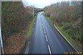
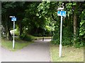
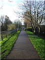
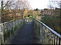
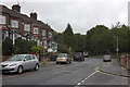
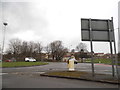
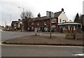
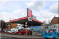
39 photos from this area
Area Information
Key information about the LU2 0TG including its size, population, and administrative classification.
- Area Type
- Postcode
- Area Size
- 1.3 hectares
- Population
- 1904
- Population Density
- 7650 people/km²
House Prices in LU2 0TG
46
Properties
£174,252
Average Sold Price
£39,000
Lowest Price
£350,000
Highest Price
Showing 46 properties
| Address | Type | Beds | Baths | Last Sale Price | Last Sale Date | |
|---|---|---|---|---|---|---|
| 97 Turners Road South, Luton, LU2 0TG | Terraced | 2 | 1 | £242,500 | Aug 2025 | |
| 107 Turners Road South, Luton, LU2 0TG | Terraced | 2 | 1 | £260,000 | Aug 2024 | |
| 121 Turners Road South, Luton, LU2 0TG | Terraced | 2 | 1 | £265,000 | Aug 2024 | |
| 62 Turners Road South, Luton, LU2 0TG | Semi-detached | 3 | 1 | £285,000 | Mar 2024 | |
| 123 Turners Road South, Luton, LU2 0TG | Terraced | 2 | 1 | £181,000 | Jan 2024 | |
| 105 Turners Road South, Luton, LU2 0TG | Terraced | 2 | 1 | £290,000 | Feb 2023 | |
| 93 Turners Road South, Luton, LU2 0TG | Semi-detached | 3 | 1 | £268,000 | Dec 2020 | |
| 32 Turners Road South, Luton, LU2 0TG | Terraced | 2 | 1 | £350,000 | Oct 2020 | |
| 101 Turners Road South, Luton, LU2 0TG | house | - | - | £237,000 | Sep 2018 | |
| 129 Turners Road South, Luton, LU2 0TG | Terraced | 3 | 2 | £270,000 | Mar 2018 |
Page 1 of 5
Energy Efficiency in LU2 0TG
Amenities
Schools
| Rank | School | Type | Entry gender | Ages |
|---|
Explore more schools in this area
Go to Schools tabDemographics
Household Size
Family (3-5 people)
most common
Accommodation Type
Houses
most common
Tenure
58
majority
Ethnic Group
White
most common
Religion
N/A
most common
Household Composition
N/A
most common
Age
47
median
Adults (30-64 years)
most common
Household Deprivation
N/A
with no deprivation
NS-SEC
27
in Lower managerial occupations
Explore more demographic insights in this area
Go to Demographics tabPlanning
Planning Constraints
- Flood RiskPremium
- Ramsar Wetland SitesPremium
- Area of Outstanding Natural BeautyPremium
- Protected Nature ReservePremium
- Protected WoodlandPremium