Area Overview for LU2 0SL
Photos of LU2 0SL
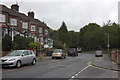
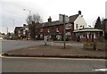
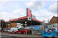
39 photos from this area
Area Information
Key information about the LU2 0SL including its size, population, and administrative classification.
- Area Type
- Postcode
- Area Size
- 4534 m²
- Population
- 1425
- Population Density
- 3283 people/km²
House Prices in LU2 0SL
11
Properties
£166,722
Average Sold Price
£53,500
Lowest Price
£302,000
Highest Price
Showing 11 properties
| Address | Type | Beds | Baths | Last Sale Price | Last Sale Date | |
|---|---|---|---|---|---|---|
| 304 Crawley Green Road, Luton, LU2 0SL | Retail | 3 | 2 | £302,000 | Dec 2021 | |
| 308 Crawley Green Road, Luton, LU2 0SL | Flat | 2 | 1 | £190,000 | Mar 2020 | |
| 294 Crawley Green Road, Luton, LU2 0SL | Semi-detached | 3 | 1 | £260,000 | Oct 2019 | |
| 302 Crawley Green Road, Luton, LU2 0SL | Terraced | 4 | 2 | £245,000 | Jul 2018 | |
| 312 Crawley Green Road, Luton, LU2 0SL | Maisonette | 1 | 1 | £82,500 | Jan 2015 | |
| 296 Crawley Green Road, Luton, LU2 0SL | Maisonette | 2 | 1 | £182,000 | Dec 2007 | |
| 306 Crawley Green Road, Luton, LU2 0SL | Flat | - | - | £104,000 | Aug 2006 | |
| 310 Crawley Green Road, Luton, LU2 0SL | Flat | 1 | 1 | £81,500 | Apr 2006 | |
| 300 Crawley Green Road, Luton, LU2 0SL | Terraced | - | - | £53,500 | Mar 1997 | |
| 298 Crawley Green Road, Luton, LU2 0SL | Terraced | 4 | 2 | - | - |
Page 1 of 2
Energy Efficiency in LU2 0SL
Amenities
Schools
| Rank | School | Type | Entry gender | Ages |
|---|
Explore more schools in this area
Go to Schools tabDemographics
Household Size
Family (3-5 people)
most common
Accommodation Type
Houses
most common
Tenure
65
majority
Ethnic Group
White
most common
Religion
N/A
most common
Household Composition
N/A
most common
Age
47
median
Adults (30-64 years)
most common
Household Deprivation
N/A
with no deprivation
NS-SEC
24
in Lower managerial occupations
Explore more demographic insights in this area
Go to Demographics tabPlanning
Planning Constraints
- Flood RiskPremium
- Ramsar Wetland SitesPremium
- Area of Outstanding Natural BeautyPremium
- Protected Nature ReservePremium
- Protected WoodlandPremium