Area Overview for LU2 0JB
Photos of LU2 0JB
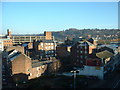
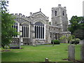


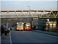
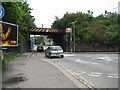
100 photos from this area
Area Information
Key information about the LU2 0JB including its size, population, and administrative classification.
- Area Type
- Postcode
- Area Size
- 1.6 hectares
- Population
- 1744
- Population Density
- 6902 people/km²
House Prices in LU2 0JB
69
Properties
£118,108
Average Sold Price
£62,750
Lowest Price
£195,000
Highest Price
Showing 69 properties
| Address | Type | Beds | Baths | Last Sale Price | Last Sale Date | |
|---|---|---|---|---|---|---|
| 41 Haddon Road, Luton, LU2 0JB | Maisonette | 1 | 1 | £140,000 | Jun 2025 | |
| 46 Haddon Road, Luton, LU2 0JB | Flat | 1 | 1 | £145,000 | Feb 2025 | |
| 17 Haddon Road, Luton, LU2 0JB | Flat | 1 | 1 | £160,000 | Feb 2024 | |
| 62 Haddon Road, Luton, LU2 0JB | Flat | 2 | 1 | £160,000 | Sep 2023 | |
| 26 Haddon Road, Luton, LU2 0JB | Maisonette | 1 | 1 | £153,000 | Jan 2022 | |
| 4 Haddon Road, Luton, LU2 0JB | Flat | - | - | £115,000 | Mar 2021 | |
| 42 Haddon Road, Luton, LU2 0JB | Maisonette | 1 | 1 | £132,000 | Nov 2020 | |
| 11 Haddon Road, Luton, LU2 0JB | Maisonette | 1 | 1 | £127,000 | Dec 2018 | |
| 48 Haddon Road, Luton, LU2 0JB | Maisonette | - | - | £138,000 | Nov 2018 | |
| 2 Haddon Road, Luton, LU2 0JB | Bungalow | 2 | 1 | £195,000 | Mar 2016 |
Page 1 of 7
Energy Efficiency in LU2 0JB
Amenities
Schools
| Rank | School | Type | Entry gender | Ages |
|---|
Explore more schools in this area
Go to Schools tabDemographics
Household Size
Family (3-5 people)
most common
Accommodation Type
Houses
most common
Tenure
40
majority
Ethnic Group
White
most common
Religion
N/A
most common
Household Composition
N/A
most common
Age
47
median
Adults (30-64 years)
most common
Household Deprivation
N/A
with no deprivation
NS-SEC
20
in Lower managerial occupations
Explore more demographic insights in this area
Go to Demographics tabPlanning
Planning Constraints
- Flood RiskPremium
- Ramsar Wetland SitesPremium
- Area of Outstanding Natural BeautyPremium
- Protected Nature ReservePremium
- Protected WoodlandPremium