Area Overview for LU2 0FU
Photos of LU2 0FU
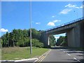
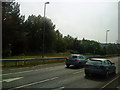
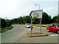
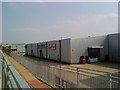
100 photos from this area
Area Information
Key information about the LU2 0FU including its size, population, and administrative classification.
- Area Type
- Postcode
- Area Size
- 1.6 hectares
- Population
- 2121
- Population Density
- 2789 people/km²
House Prices in LU2 0FU
76
Properties
£323,531
Average Sold Price
£190,000
Lowest Price
£429,995
Highest Price
Showing 76 properties
| Address | Type | Beds | Baths | Last Sale Price | Last Sale Date | |
|---|---|---|---|---|---|---|
| 1 Armstrong Road, Luton, LU2 0FU | Flat | - | - | £255,000 | Jul 2025 | |
| 5 Armstrong Road, Luton, LU2 0FU | Flat | - | - | £190,000 | Oct 2024 | |
| 3 Armstrong Road, Luton, LU2 0FU | Flat | 1 | 1 | £233,333 | Oct 2024 | |
| 65 Armstrong Road, Luton, LU2 0FU | Flat | 4 | 2 | £400,000 | Sep 2024 | |
| 29 Armstrong Road, Luton, LU2 0FU | Flat | 1 | 1 | £202,000 | Nov 2023 | |
| 25 Armstrong Road, Luton, LU2 0FU | Flat | 1 | 1 | £273,000 | Feb 2023 | |
| 15 Armstrong Road, Luton, LU2 0FU | Flat | 1 | 1 | £192,000 | Nov 2021 | |
| 77 Armstrong Road, Luton, LU2 0FU | house | - | - | £387,995 | Jan 2019 | |
| 75 Armstrong Road, Luton, LU2 0FU | Semi-detached | 3 | 2 | £387,995 | Jan 2019 | |
| 73 Armstrong Road, Luton, LU2 0FU | house | - | - | £387,995 | Jan 2019 |
Page 1 of 8
Energy Efficiency in LU2 0FU
Amenities
Schools
| Rank | School | Type | Entry gender | Ages |
|---|
Explore more schools in this area
Go to Schools tabDemographics
Household Size
Two person
most common
Accommodation Type
Houses
most common
Tenure
68
majority
Ethnic Group
White
most common
Religion
N/A
most common
Household Composition
N/A
most common
Age
47
median
Adults (30-64 years)
most common
Household Deprivation
N/A
with no deprivation
NS-SEC
35
in Lower managerial occupations
Explore more demographic insights in this area
Go to Demographics tabPlanning
Planning Constraints
- Flood RiskPremium
- Ramsar Wetland SitesPremium
- Area of Outstanding Natural BeautyPremium
- Protected Nature ReservePremium
- Protected WoodlandPremium