Area Overview for LU2 0DN
Photos of LU2 0DN

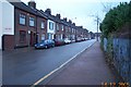
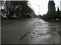
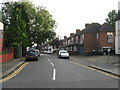
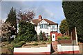
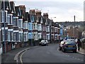
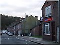
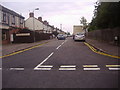
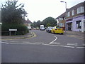

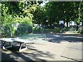
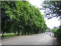
17 photos from this area
Area Information
Key information about the LU2 0DN including its size, population, and administrative classification.
- Area Type
- Postcode
- Area Size
- 8890 m²
- Population
- 1981
- Population Density
- 9438 people/km²
House Prices in LU2 0DN
56
Properties
£232,875
Average Sold Price
£38,000
Lowest Price
£625,000
Highest Price
Showing 56 properties
| Address | Type | Beds | Baths | Last Sale Price | Last Sale Date | |
|---|---|---|---|---|---|---|
| 198 High Town Road, Luton, LU2 0DN | Terraced | 3 | - | £280,000 | Jul 2025 | |
| 244 High Town Road, Luton, LU2 0DN | Terraced | 3 | 1 | £285,000 | Sep 2023 | |
| 186 High Town Road, Luton, LU2 0DN | Terraced | 3 | 5 | £238,000 | Oct 2022 | |
| 190 High Town Road, Luton, LU2 0DN | house | - | - | £245,000 | Jan 2022 | |
| 226 High Town Road, Luton, LU2 0DN | Terraced | 3 | 2 | £265,000 | Oct 2021 | |
| Hillcroft, 258 High Town Road, Luton, LU2 0DN | Flat | - | - | £625,000 | Sep 2021 | |
| 192 High Town Road, Luton, LU2 0DN | Flat | 1 | 1 | £270,000 | May 2021 | |
| 248 High Town Road, Luton, LU2 0DN | house | - | - | £243,000 | Nov 2020 | |
| 228 High Town Road, Luton, LU2 0DN | Terraced | 4 | - | £263,000 | Aug 2017 | |
| 236 High Town Road, Luton, LU2 0DN | house | 6 | 6 | £270,000 | Jul 2015 |
Page 1 of 6
Energy Efficiency in LU2 0DN
Amenities
Schools
| Rank | School | Type | Entry gender | Ages |
|---|
Explore more schools in this area
Go to Schools tabDemographics
Household Size
Family (3-5 people)
most common
Accommodation Type
Houses
most common
Tenure
37
majority
Ethnic Group
White
most common
Religion
N/A
most common
Household Composition
N/A
most common
Age
47
median
Adults (30-64 years)
most common
Household Deprivation
N/A
with no deprivation
NS-SEC
22
in Lower managerial occupations
Explore more demographic insights in this area
Go to Demographics tabPlanning
Planning Constraints
- Flood RiskPremium
- Ramsar Wetland SitesPremium
- Area of Outstanding Natural BeautyPremium
- Protected Nature ReservePremium
- Protected WoodlandPremium