Area Overview for LU1 5LE
Photos of LU1 5LE
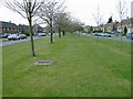
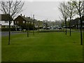
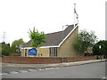

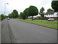
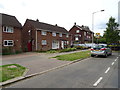
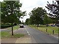
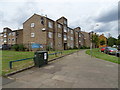
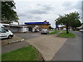
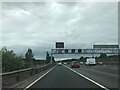

24 photos from this area
Area Information
Key information about the LU1 5LE including its size, population, and administrative classification.
- Area Type
- Postcode
- Area Size
- 1.2 hectares
- Population
- 1614
- Population Density
- 7120 people/km²
House Prices in LU1 5LE
25
Properties
£184,728
Average Sold Price
£41,515
Lowest Price
£315,000
Highest Price
Showing 25 properties
| Address | Type | Beds | Baths | Last Sale Price | Last Sale Date | |
|---|---|---|---|---|---|---|
| 125 Whipperley Way, Luton, LU1 5LE | house | - | - | £315,000 | Nov 2025 | |
| 109 Whipperley Way, Luton, LU1 5LE | Terraced | 3 | 2 | £240,000 | Sep 2025 | |
| 105 Whipperley Way, Luton, LU1 5LE | house | 3 | - | £265,000 | Dec 2020 | |
| 119 Whipperley Way, Luton, LU1 5LE | house | - | - | £265,000 | Feb 2018 | |
| 117 Whipperley Way, Luton, LU1 5LE | Terraced | - | - | £270,000 | Dec 2017 | |
| 133 Whipperley Way, Luton, LU1 5LE | Semi-detached | 4 | 2 | £223,000 | Sep 2014 | |
| 129 Whipperley Way, Luton, LU1 5LE | house | 3 | - | £155,000 | Mar 2012 | |
| 93 Whipperley Way, Luton, LU1 5LE | Semi-detached | 3 | 1 | £152,000 | Jul 2008 | |
| 95 Whipperley Way, Luton, LU1 5LE | Semi-detached | 3 | 1 | £165,000 | Jun 2007 | |
| 121 Whipperley Way, Luton, LU1 5LE | Terraced | 3 | 1 | £140,000 | May 2006 |
Page 1 of 3
Energy Efficiency in LU1 5LE
Amenities
Schools
| Rank | School | Type | Entry gender | Ages |
|---|
Explore more schools in this area
Go to Schools tabDemographics
Household Size
Family (3-5 people)
most common
Accommodation Type
Houses
most common
Tenure
61
majority
Ethnic Group
White
most common
Religion
N/A
most common
Household Composition
N/A
most common
Age
47
median
Adults (30-64 years)
most common
Household Deprivation
N/A
with no deprivation
NS-SEC
18
in Lower managerial occupations
Explore more demographic insights in this area
Go to Demographics tabPlanning
Planning Constraints
- Flood RiskPremium
- Ramsar Wetland SitesPremium
- Area of Outstanding Natural BeautyPremium
- Protected Nature ReservePremium
- Protected WoodlandPremium