Area Overview for LU1 5JN
Photos of LU1 5JN
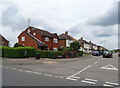
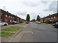
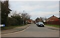
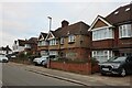
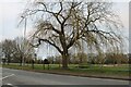
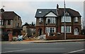
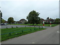
66 photos from this area
Area Information
Key information about the LU1 5JN including its size, population, and administrative classification.
- Area Type
- Postcode
- Area Size
- 8875 m²
- Population
- 2013
- Population Density
- 6205 people/km²
House Prices in LU1 5JN
32
Properties
£162,694
Average Sold Price
£40,000
Lowest Price
£308,000
Highest Price
Showing 32 properties
| Address | Type | Beds | Baths | Last Sale Price | Last Sale Date | |
|---|---|---|---|---|---|---|
| 27 Meyrick Avenue, Luton, LU1 5JN | Semi-detached | 3 | 1 | £308,000 | Sep 2021 | |
| 37 Meyrick Avenue, Luton, LU1 5JN | house | - | - | £295,000 | Jun 2017 | |
| 21 Meyrick Avenue, Luton, LU1 5JN | Detached | 3 | 1 | £300,000 | Sep 2016 | |
| 9 Meyrick Avenue, Luton, LU1 5JN | Semi-detached | 3 | - | £195,000 | Oct 2015 | |
| 7 Meyrick Avenue, Luton, LU1 5JN | Semi-detached | 3 | 1 | £204,000 | Mar 2015 | |
| 11 Meyrick Avenue, Luton, LU1 5JN | Semi-detached | 3 | 1 | £162,000 | Jun 2013 | |
| 31 Meyrick Avenue, Luton, LU1 5JN | Semi-detached | - | - | £180,000 | Mar 2006 | |
| 39 Meyrick Avenue, Luton, LU1 5JN | Semi-detached | 3 | 1 | £164,000 | Jul 2004 | |
| 41 Meyrick Avenue, Luton, LU1 5JN | Semi-detached | - | - | £149,000 | Apr 2004 | |
| 49 Meyrick Avenue, Luton, LU1 5JN | house | - | - | £159,000 | Mar 2004 |
Page 1 of 4
Energy Efficiency in LU1 5JN
Amenities
Schools
| Rank | School | Type | Entry gender | Ages |
|---|
Explore more schools in this area
Go to Schools tabDemographics
Household Size
Family (3-5 people)
most common
Accommodation Type
Houses
most common
Tenure
63
majority
Ethnic Group
White
most common
Religion
N/A
most common
Household Composition
N/A
most common
Age
47
median
Adults (30-64 years)
most common
Household Deprivation
N/A
with no deprivation
NS-SEC
21
in Lower managerial occupations
Explore more demographic insights in this area
Go to Demographics tabPlanning
Planning Constraints
- Flood RiskPremium
- Ramsar Wetland SitesPremium
- Area of Outstanding Natural BeautyPremium
- Protected Nature ReservePremium
- Protected WoodlandPremium