Area Overview for LU1 5HJ
Photos of LU1 5HJ
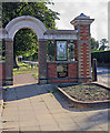
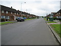
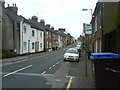
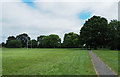
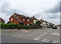
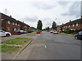
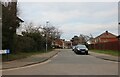
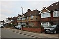
66 photos from this area
Area Information
Key information about the LU1 5HJ including its size, population, and administrative classification.
- Area Type
- Postcode
- Area Size
- 3868 m²
- Population
- 1997
- Population Density
- 2506 people/km²
House Prices in LU1 5HJ
10
Properties
£276,357
Average Sold Price
£87,000
Lowest Price
£480,000
Highest Price
Showing 10 properties
| Address | Type | Beds | Baths | Last Sale Price | Last Sale Date | |
|---|---|---|---|---|---|---|
| 66 Farley Hill, Luton, LU1 5HJ | Retail | 3 | 1 | £297,500 | Aug 2022 | |
| 68 Farley Hill, Luton, LU1 5HJ | house | - | - | £327,000 | Sep 2021 | |
| 78 Farley Hill, Luton, LU1 5HJ | house | - | - | £480,000 | Jun 2021 | |
| 72A Farley Hill, Luton, LU1 5HJ | Semi-detached | 4 | 1 | £306,000 | Aug 2019 | |
| 72B Farley Hill, Luton, LU1 5HJ | Semi-detached | 3 | 3 | £247,000 | Jul 2018 | |
| 80 Farley Hill, Luton, LU1 5HJ | Semi-detached | 3 | - | £190,000 | Mar 2013 | |
| 74 Farley Hill, Luton, LU1 5HJ | Semi-detached | - | - | £87,000 | Mar 2000 | |
| 64 Farley Hill, Luton, LU1 5HJ | Semi-detached | 4 | 2 | - | - | |
| 76 Farley Hill, Luton, LU1 5HJ | Semi-detached | - | - | - | - | |
| 70 Farley Hill, Luton, LU1 5HJ | Terraced | - | - | - | - |
Energy Efficiency in LU1 5HJ
Amenities
Schools
| Rank | School | Type | Entry gender | Ages |
|---|
Explore more schools in this area
Go to Schools tabDemographics
Household Size
One person
most common
Accommodation Type
Flats
most common
Tenure
36
majority
Ethnic Group
White
most common
Religion
N/A
most common
Household Composition
N/A
most common
Age
47
median
Adults (30-64 years)
most common
Household Deprivation
N/A
with no deprivation
NS-SEC
23
in Lower managerial occupations
Explore more demographic insights in this area
Go to Demographics tabPlanning
Planning Constraints
- Flood RiskPremium
- Ramsar Wetland SitesPremium
- Area of Outstanding Natural BeautyPremium
- Protected Nature ReservePremium
- Protected WoodlandPremium