Area Overview for LU1 5AN
Photos of LU1 5AN
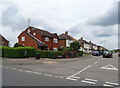
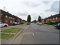
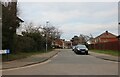
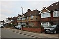
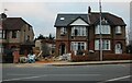
66 photos from this area
Area Information
Key information about the LU1 5AN including its size, population, and administrative classification.
- Area Type
- Postcode
- Area Size
- 4119 m²
- Population
- 1929
- Population Density
- 13051 people/km²
House Prices in LU1 5AN
55
Properties
£138,000
Average Sold Price
£30,000
Lowest Price
£230,000
Highest Price
Showing 55 properties
| Address | Type | Beds | Baths | Last Sale Price | Last Sale Date | |
|---|---|---|---|---|---|---|
| 24 Stanley Street, Luton, LU1 5AN | house | 2 | 1 | £230,000 | Sep 2022 | |
| 32 Stanley Street, Luton, LU1 5AN | Terraced | 2 | 2 | £206,000 | Sep 2021 | |
| 38 Stanley Street, Luton, LU1 5AN | Terraced | 2 | 1 | £201,000 | Jan 2018 | |
| 22 Stanley Street, Luton, LU1 5AN | Terraced | 2 | 1 | £200,000 | Aug 2017 | |
| 36 Stanley Street, Luton, LU1 5AN | Terraced | 2 | 1 | £171,000 | Aug 2015 | |
| 10 Stanley Street, Luton, LU1 5AN | Terraced | 4 | 1 | £165,000 | Jun 2015 | |
| 44 Stanley Street, Luton, LU1 5AN | house | - | - | £118,000 | Mar 2015 | |
| 20 Stanley Street, Luton, LU1 5AN | house | - | - | £125,000 | Nov 2014 | |
| 26 Stanley Street, Luton, LU1 5AN | Terraced | 2 | 1 | £115,000 | Apr 2014 | |
| 28 Stanley Street, Luton, LU1 5AN | Terraced | 2 | 1 | £120,000 | Mar 2014 |
Page 1 of 6
Energy Efficiency in LU1 5AN
Amenities
Schools
| Rank | School | Type | Entry gender | Ages |
|---|
Explore more schools in this area
Go to Schools tabDemographics
Household Size
Family (3-5 people)
most common
Accommodation Type
Houses
most common
Tenure
26
majority
Ethnic Group
White
most common
Religion
N/A
most common
Household Composition
N/A
most common
Age
47
median
Adults (30-64 years)
most common
Household Deprivation
N/A
with no deprivation
NS-SEC
14
in Lower managerial occupations
Explore more demographic insights in this area
Go to Demographics tabPlanning
Planning Constraints
- Flood RiskPremium
- Ramsar Wetland SitesPremium
- Area of Outstanding Natural BeautyPremium
- Protected Nature ReservePremium
- Protected WoodlandPremium