Area Overview for LU1 3UE
Photos of LU1 3UE


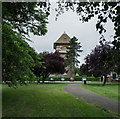
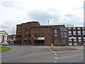
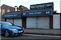
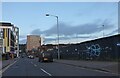
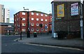

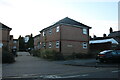


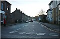
100 photos from this area
Area Information
Key information about the LU1 3UE including its size, population, and administrative classification.
- Area Type
- Postcode
- Area Size
- 5687 m²
- Population
- 1784
- Population Density
- 3663 people/km²
House Prices in LU1 3UE
60
Properties
£218,261
Average Sold Price
£53,000
Lowest Price
£650,000
Highest Price
Showing 60 properties
| Address | Type | Beds | Baths | Last Sale Price | Last Sale Date | |
|---|---|---|---|---|---|---|
| 31 London Road, Luton, LU1 3UE | Terraced | 4 | 2 | £390,000 | Nov 2024 | |
| 13 London Road, Luton, LU1 3UE | Semi-detached | 5 | 2 | £650,000 | May 2024 | |
| 45 London Road, Luton, LU1 3UE | house | - | - | £225,000 | May 2023 | |
| 27 London Road, Luton, LU1 3UE | Terraced | 4 | 2 | £350,000 | Aug 2022 | |
| 5 London Road, Luton, LU1 3UE | Flat | 4 | 2 | £185,000 | Jul 2021 | |
| 39 London Road, Luton, LU1 3UE | Terraced | 3 | 1 | £300,000 | Feb 2018 | |
| 37 London Road, Luton, LU1 3UE | house | 3 | 3 | £325,000 | Feb 2018 | |
| 51 London Road, Luton, LU1 3UE | Terraced | 2 | 1 | £127,750 | Apr 2017 | |
| 49 London Road, Luton, LU1 3UE | house | - | - | £180,000 | Aug 2016 | |
| 25 London Road, Luton, LU1 3UE | Terraced | 1 | 1 | £191,000 | Apr 2014 |
Page 1 of 6
Energy Efficiency in LU1 3UE
Amenities
Schools
| Rank | School | Type | Entry gender | Ages |
|---|
Explore more schools in this area
Go to Schools tabDemographics
Household Size
Family (3-5 people)
most common
Accommodation Type
Houses
most common
Tenure
56
majority
Ethnic Group
White
most common
Religion
N/A
most common
Household Composition
N/A
most common
Age
47
median
Adults (30-64 years)
most common
Household Deprivation
N/A
with no deprivation
NS-SEC
31
in Lower managerial occupations
Explore more demographic insights in this area
Go to Demographics tabPlanning
Planning Constraints
- Flood RiskPremium
- Ramsar Wetland SitesPremium
- Area of Outstanding Natural BeautyPremium
- Protected Nature ReservePremium
- Protected WoodlandPremium