Area Overview for LU1 3QE
Photos of LU1 3QE


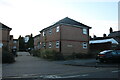


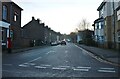
100 photos from this area
Area Information
Key information about the LU1 3QE including its size, population, and administrative classification.
- Area Type
- Postcode
- Area Size
- 7317 m²
- Population
- 1750
- Population Density
- 18135 people/km²
House Prices in LU1 3QE
71
Properties
£164,751
Average Sold Price
£48,000
Lowest Price
£347,000
Highest Price
Showing 71 properties
| Address | Type | Beds | Baths | Last Sale Price | Last Sale Date | |
|---|---|---|---|---|---|---|
| 16 Ashton Road, Luton, LU1 3QE | Terraced | 2 | 1 | £225,000 | Jul 2025 | |
| 47 Ashton Road, Luton, LU1 3QE | Terraced | 2 | 1 | £237,500 | Jun 2025 | |
| 14 Ashton Road, Luton, LU1 3QE | Terraced | 2 | 1 | £215,000 | Jun 2025 | |
| 23 Ashton Road, Luton, LU1 3QE | house | 3 | 1 | £300,000 | Jan 2025 | |
| 10 Ashton Road, Luton, LU1 3QE | Terraced | 1 | 1 | £197,000 | Mar 2024 | |
| 31 Ashton Road, Luton, LU1 3QE | house | - | - | £301,000 | Dec 2022 | |
| 33 Ashton Road, Luton, LU1 3QE | Retail | 3 | 2 | £315,000 | Nov 2022 | |
| 48 Ashton Road, Luton, LU1 3QE | Semi-detached | 2 | 1 | £240,000 | Jul 2022 | |
| 50 Ashton Road, Luton, LU1 3QE | house | - | - | £225,000 | Nov 2021 | |
| 20 Ashton Road, Luton, LU1 3QE | house | 2 | 1 | £190,368 | Jul 2021 |
Page 1 of 8
Energy Efficiency in LU1 3QE
Amenities
Schools
| Rank | School | Type | Entry gender | Ages |
|---|
Explore more schools in this area
Go to Schools tabDemographics
Household Size
One person
most common
Accommodation Type
Houses
most common
Tenure
15
majority
Ethnic Group
White
most common
Religion
N/A
most common
Household Composition
N/A
most common
Age
47
median
Adults (30-64 years)
most common
Household Deprivation
N/A
with no deprivation
NS-SEC
17
in Lower managerial occupations
Explore more demographic insights in this area
Go to Demographics tabPlanning
Planning Constraints
- Flood RiskPremium
- Ramsar Wetland SitesPremium
- Area of Outstanding Natural BeautyPremium
- Protected Nature ReservePremium
- Protected WoodlandPremium