Area Overview for LU1 3NF
Photos of LU1 3NF


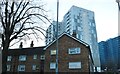
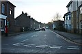
100 photos from this area
Area Information
Key information about the LU1 3NF including its size, population, and administrative classification.
- Area Type
- Postcode
- Area Size
- 3.4 hectares
- Population
- 1622
- Population Density
- 1926 people/km²
House Prices in LU1 3NF
57
Properties
£246,978
Average Sold Price
£57,500
Lowest Price
£425,000
Highest Price
Showing 57 properties
| Address | Type | Beds | Baths | Last Sale Price | Last Sale Date | |
|---|---|---|---|---|---|---|
| 132 Cutenhoe Road, Luton, LU1 3NF | house | - | - | £265,000 | Aug 2024 | |
| 84 Cutenhoe Road, Luton, LU1 3NF | house | - | - | £425,000 | Aug 2023 | |
| 86 Cutenhoe Road, Luton, LU1 3NF | Semi-detached | 3 | 2 | £425,000 | Jun 2023 | |
| 158 Cutenhoe Road, Luton, LU1 3NF | Semi-detached | 3 | 1 | £353,000 | Jan 2022 | |
| 116 Cutenhoe Road, Luton, LU1 3NF | house | - | - | £350,000 | Sep 2021 | |
| 160 Cutenhoe Road, Luton, LU1 3NF | house | - | - | £368,000 | Jun 2021 | |
| 176 Cutenhoe Road, Luton, LU1 3NF | house | - | - | £395,000 | Mar 2021 | |
| 88 Cutenhoe Road, Luton, LU1 3NF | Semi-detached | 3 | - | £358,000 | Mar 2021 | |
| 102 Cutenhoe Road, Luton, LU1 3NF | Semi-detached | 3 | - | £340,000 | Mar 2021 | |
| 112 Cutenhoe Road, Luton, LU1 3NF | Semi-detached | 3 | 2 | £330,000 | Aug 2020 |
Page 1 of 6
Energy Efficiency in LU1 3NF
Amenities
Schools
| Rank | School | Type | Entry gender | Ages |
|---|
Explore more schools in this area
Go to Schools tabDemographics
Household Size
Family (3-5 people)
most common
Accommodation Type
Houses
most common
Tenure
55
majority
Ethnic Group
White
most common
Religion
N/A
most common
Household Composition
N/A
most common
Age
47
median
Adults (30-64 years)
most common
Household Deprivation
N/A
with no deprivation
NS-SEC
26
in Lower managerial occupations
Explore more demographic insights in this area
Go to Demographics tabPlanning
Planning Constraints
- Flood RiskPremium
- Ramsar Wetland SitesPremium
- Area of Outstanding Natural BeautyPremium
- Protected Nature ReservePremium
- Protected WoodlandPremium