Area Overview for LU1 2RE
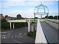
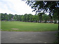
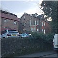
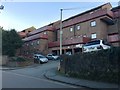
Photos of LU1 2RE


Area Information
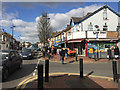
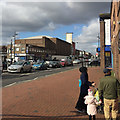
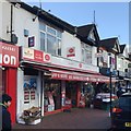
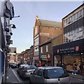
Living in LU1 2RE means being part of a small, tightly knit residential cluster in England with a population of just 1,576. This area is characterised by its compact size and proximity to key transport links, making it a practical choice for those prioritising connectivity. The community is predominantly composed of adults aged 30–64, though the median age is notably lower at 22, suggesting a mix of younger professionals and students. Daily life here is shaped by easy access to retail, rail, and air travel. Residents can walk or cycle to nearby supermarkets such as Lidl, Sainsburys, and Farmfoods in Luton, while the area’s railway stations—including Luton and Leagrave—offer direct links to London and surrounding towns. LU1 2RE’s location near London Luton Airport adds to its appeal for those needing frequent travel. However, the area’s small size means it is best suited to those seeking a quiet, low-density living environment with a strong focus on practicality over sprawling amenities.
- Area Type
- Postcode
- Area Size
- Not available
- Population
- 1576
- Population Density
- 8805 people/km²
The property market in LU1 2RE is defined by a low home ownership rate—just 10% of residents own their homes—with flats making up the majority of accommodation. This suggests a rental market that dominates the area, likely catering to commuters or students seeking short-term stays. The small size of LU1 2RE means housing stock is limited, and buyers looking for owner-occupied properties may find opportunities scarce. Flats are the primary housing type, which could be a consideration for those preferring larger homes or family-friendly layouts. The area’s proximity to transport links, including multiple railway stations and London Luton Airport, may drive demand from renters prioritising convenience. For buyers, the limited availability of owner-occupied properties and the flat-centric market mean that LU1 2RE is not ideal for those seeking a long-term, family-oriented home.
House Prices in LU1 2RE
No properties found in this postcode.
Energy Efficiency in LU1 2RE
Residents of LU1 2RE have access to a range of nearby amenities that support daily life. The area’s retail options include major supermarkets such as Lidl, Sainsburys, and Farmfoods in Luton, all within walking or cycling distance. For transport, the proximity to Luton Railway Station, Leagrave Railway Station, and Luton Airport Parkway ensures easy access to regional and national travel. London Luton Airport, just 2 kilometres away, provides international connectivity. While the area lacks expansive parks or leisure facilities, its compact size means residents can reach urban centres quickly. The availability of multiple retail and transport hubs suggests a lifestyle focused on convenience and accessibility, though those seeking extensive green spaces or cultural amenities may need to look further afield.
Amenities
Schools
| Rank | School | Type | Entry gender | Ages |
|---|
Explore more schools in this area
Go to Schools tabDemographics
The community in LU1 2RE is predominantly composed of adults aged 30–64, with a median age of 22, indicating a younger demographic than the overall age range suggests. This discrepancy may reflect the presence of students or younger professionals. Only 10% of residents own their homes, with flats being the primary accommodation type. This points to a rental-heavy market, which influences the area’s social dynamics and housing availability. The predominant ethnic group is White, with no specific data provided on other demographics. The low home ownership rate and flat-dominated housing stock suggest a transient population, possibly linked to commuting patterns or temporary housing needs. While the data does not quantify deprivation levels, the high proportion of renters and younger residents may indicate a community focused on affordability and flexibility rather than long-term stability.
Household Size
Accommodation Type
Tenure
Ethnic Group
Religion
Household Composition
Age
Household Deprivation
NS-SEC
Explore more demographic insights in this area
Go to Demographics tabPlanning
Planning Constraints
- Flood RiskPremium
- Ramsar Wetland SitesPremium
- Area of Outstanding Natural BeautyPremium
- Protected Nature ReservePremium
- Protected WoodlandPremium