Area Overview for LU1 2NG
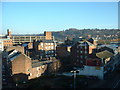
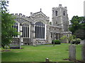
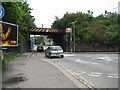
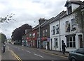
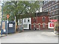
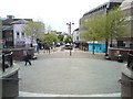
Photos of LU1 2NG


Area Information
LU1 2NG is a compact residential postcode in England, covering just 2360 m² and home to 1576 residents. Its population density of 667,850 people per km² reflects a tightly packed community, typical of urban or semi-urban settings. The area’s small size means it is likely a focused cluster of properties, possibly centred around local amenities or transport hubs. With a median age of 22, the area skews younger than average, though the most common age group is adults aged 30–64. This suggests a mix of students, young professionals, or families in early adulthood. The proximity to Luton Railway Station, Leagrave Station, and London Luton Airport underscores its connectivity, making it appealing for commuters or those needing frequent travel. Daily life here is likely shaped by the need for efficient transport, with retail options like Lidl and Sainsburys within reach. The area’s small footprint means it is a microcosm of urban living, where proximity to services and transport is key, though the high density may influence the character of the neighbourhood.
- Area Type
- Postcode
- Area Size
- 2360 m²
- Population
- 1576
- Population Density
- 8805 people/km²
LU1 2NG is a rental-dominated area, with just 10% of residents owning their homes. The accommodation type is almost exclusively flats, reflecting a housing stock tailored to smaller households or individuals. This suggests the area is not suited for long-term homeownership, particularly for families seeking larger properties. The small size of the postcode means the housing market is limited, with little scope for expansion or new developments. Buyers looking at LU1 2NG should consider the area’s role as a short-term or transitional residence, given the high proportion of renters. The concentration of flats may also indicate proximity to larger urban centres, where demand for rental properties is higher. For those prioritising ownership, nearby areas with more diverse housing stock may be more viable.
House Prices in LU1 2NG
Showing 1 properties
| Address | Type | Beds | Baths | Last Sale Price | Last Sale Date | |
|---|---|---|---|---|---|---|
| St Georges Theatre, Library Road, Luton, LU1 2NG | restaurant_cafe | - | - | - | - |
Energy Efficiency in LU1 2NG
The lifestyle in LU1 2NG is shaped by its proximity to essential amenities. Retail options include Lidl Luton, Farmfoods Luton, and Sainsburys Luton, providing daily shopping convenience. The area’s direct access to London Luton Airport makes it ideal for those needing frequent travel, whether for work or leisure. While the data does not mention parks or leisure facilities, the presence of multiple rail stations and retail hubs suggests a focus on practicality over green spaces. The compact nature of the area means residents can access services quickly, though the lack of detailed information on recreational options leaves gaps in understanding the full range of lifestyle opportunities.
Amenities
Schools
| Rank | School | Type | Entry gender | Ages |
|---|
Explore more schools in this area
Go to Schools tabDemographics
The population of LU1 2NG is predominantly adults aged 30–64, despite a median age of 22. This suggests a community where younger residents coexist with older, possibly established households. Only 10% of residents own their homes, with flats being the primary accommodation type. This indicates a rental-heavy market, likely influenced by the area’s compact size and limited housing stock. The predominant ethnic group is White, though no data on diversity beyond this is provided. The low home ownership rate may reflect the area’s role as a transitional or temporary residence for students, workers, or those seeking affordable housing. The high population density, combined with a young median age, could point to a dynamic but potentially transient community. However, the absence of detailed data on deprivation or income levels means the quality of life implications of these demographics remain unexplored.
Household Size
Accommodation Type
Tenure
Ethnic Group
Religion
Household Composition
Age
Household Deprivation
NS-SEC
Explore more demographic insights in this area
Go to Demographics tabPlanning
Planning Constraints
- Flood RiskPremium
- Ramsar Wetland SitesPremium
- Area of Outstanding Natural BeautyPremium
- Protected Nature ReservePremium
- Protected WoodlandPremium