Area Overview for LU1 1TT
Photos of LU1 1TT
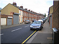

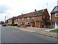
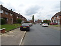

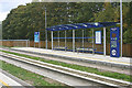

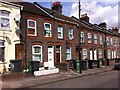
16 photos from this area
Area Information
Key information about the LU1 1TT including its size, population, and administrative classification.
- Area Type
- Postcode
- Area Size
- 1.4 hectares
- Population
- 2567
- Population Density
- 4680 people/km²
House Prices in LU1 1TT
39
Properties
£148,217
Average Sold Price
£34,950
Lowest Price
£310,000
Highest Price
Showing 39 properties
| Address | Type | Beds | Baths | Last Sale Price | Last Sale Date | |
|---|---|---|---|---|---|---|
| 110 Kingsway, Luton, LU1 1TT | Terraced | 3 | 1 | £260,000 | Nov 2023 | |
| 154 Kingsway, Luton, LU1 1TT | Terraced | 3 | 1 | £280,000 | Mar 2023 | |
| 146 Kingsway, Luton, LU1 1TT | Terraced | 3 | 2 | £310,000 | Oct 2022 | |
| 156 Kingsway, Luton, LU1 1TT | house | 3 | - | £235,000 | Nov 2020 | |
| 116 Kingsway, Luton, LU1 1TT | Terraced | 3 | 2 | £294,000 | Jun 2020 | |
| 148 Kingsway, Luton, LU1 1TT | Terraced | - | - | £155,000 | Feb 2020 | |
| 134 Kingsway, Luton, LU1 1TT | Terraced | 5 | 2 | £220,000 | Jun 2019 | |
| 106 Kingsway, Luton, LU1 1TT | house | - | - | £136,000 | Mar 2019 | |
| 164 Kingsway, Luton, LU1 1TT | house | - | - | £168,000 | Aug 2014 | |
| 138 Kingsway, Luton, LU1 1TT | Terraced | 3 | - | £155,000 | Oct 2013 |
Page 1 of 4
Energy Efficiency in LU1 1TT
Amenities
Schools
| Rank | School | Type | Entry gender | Ages |
|---|
Explore more schools in this area
Go to Schools tabDemographics
Household Size
Family (3-5 people)
most common
Accommodation Type
Houses
most common
Tenure
49
majority
Ethnic Group
asian_total
most common
Religion
N/A
most common
Household Composition
N/A
most common
Age
22
median
Adults (30-64 years)
most common
Household Deprivation
N/A
with no deprivation
NS-SEC
16
in Lower managerial occupations
Explore more demographic insights in this area
Go to Demographics tabPlanning
Planning Constraints
- Flood RiskPremium
- Ramsar Wetland SitesPremium
- Area of Outstanding Natural BeautyPremium
- Protected Nature ReservePremium
- Protected WoodlandPremium