Area Overview for LU1 1NW
Photos of LU1 1NW


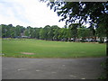


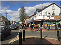

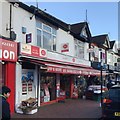

65 photos from this area
Area Information
Key information about the LU1 1NW including its size, population, and administrative classification.
- Area Type
- Postcode
- Area Size
- 2063 m²
- Population
- 2296
- Population Density
- 12459 people/km²
House Prices in LU1 1NW
16
Properties
£166,828
Average Sold Price
£22,500
Lowest Price
£750,000
Highest Price
Showing 16 properties
| Address | Type | Beds | Baths | Last Sale Price | Last Sale Date | |
|---|---|---|---|---|---|---|
| 89 Dallow Road, Luton, LU1 1NW | house | - | - | £250,000 | Apr 2021 | |
| 93 Dallow Road, Luton, LU1 1NW | house | - | - | £140,000 | Dec 2010 | |
| 81A Dallow Road, Luton, LU1 1NW | Flat | - | - | £93,000 | Mar 2007 | |
| 87 Dallow Road, Luton, LU1 1NW | Terraced | - | - | £76,000 | Dec 2001 | |
| 85 Dallow Road, Luton, LU1 1NW | Terraced | - | - | £69,000 | Jun 2001 | |
| 91 Dallow Road, Luton, LU1 1NW | Terraced | - | - | £65,000 | Jul 2000 | |
| 99 Dallow Road, Luton, LU1 1NW | Terraced | - | - | £750,000 | Mar 2000 | |
| 99A Dallow Road, Luton, LU1 1NW | Flat | - | - | £22,500 | Feb 2000 | |
| 97 Dallow Road, Luton, LU1 1NW | Terraced | - | - | £35,950 | Jun 1995 | |
| 99B Dallow Road, Luton, LU1 1NW | Flat | - | - | - | - |
Page 1 of 2
Energy Efficiency in LU1 1NW
Amenities
Schools
| Rank | School | Type | Entry gender | Ages |
|---|
Explore more schools in this area
Go to Schools tabDemographics
Household Size
Family (3-5 people)
most common
Accommodation Type
Houses
most common
Tenure
28
majority
Ethnic Group
asian_total
most common
Religion
N/A
most common
Household Composition
N/A
most common
Age
47
median
Adults (30-64 years)
most common
Household Deprivation
N/A
with no deprivation
NS-SEC
11
in Lower managerial occupations
Explore more demographic insights in this area
Go to Demographics tabPlanning
Planning Constraints
- Flood RiskPremium
- Ramsar Wetland SitesPremium
- Area of Outstanding Natural BeautyPremium
- Protected Nature ReservePremium
- Protected WoodlandPremium