Area Overview for LU1 1JU
Photos of LU1 1JU

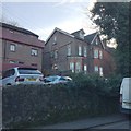
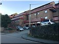
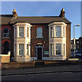
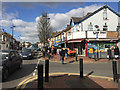
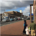
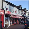
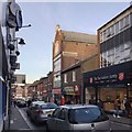
65 photos from this area
Area Information
Key information about the LU1 1JU including its size, population, and administrative classification.
- Area Type
- Postcode
- Area Size
- 1804 m²
- Population
- 2478
- Population Density
- 12490 people/km²
House Prices in LU1 1JU
17
Properties
£208,375
Average Sold Price
£121,000
Lowest Price
£350,000
Highest Price
Showing 17 properties
| Address | Type | Beds | Baths | Last Sale Price | Last Sale Date | |
|---|---|---|---|---|---|---|
| 94 Ashburnham Road, Luton, LU1 1JU | house | 3 | 2 | £350,000 | Aug 2022 | |
| 100 Ashburnham Road, Luton, LU1 1JU | Terraced | 5 | 1 | £270,000 | Feb 2020 | |
| 98 Ashburnham Road, Luton, LU1 1JU | Terraced | 3 | 1 | £232,000 | Mar 2018 | |
| 106 Ashburnham Road, Luton, LU1 1JU | house | - | - | £166,000 | Sep 2017 | |
| 112 Ashburnham Road, Luton, LU1 1JU | Terraced | 3 | - | £235,000 | Dec 2015 | |
| 114 Ashburnham Road, Luton, LU1 1JU | Terraced | 1 | 1 | £167,000 | May 2015 | |
| 104 Ashburnham Road, Luton, LU1 1JU | house | 3 | - | £126,000 | Apr 2010 | |
| 96 Ashburnham Road, Luton, LU1 1JU | Terraced | 3 | 2 | £121,000 | Nov 2002 | |
| Flat 1, 110 Ashburnham Road, Luton, LU1 1JU | Flat | - | - | - | - | |
| Flat 2, 110 Ashburnham Road, Luton, LU1 1JU | Flat | - | - | - | - |
Page 1 of 2
Energy Efficiency in LU1 1JU
Amenities
Schools
| Rank | School | Type | Entry gender | Ages |
|---|
Explore more schools in this area
Go to Schools tabDemographics
Household Size
Family (3-5 people)
most common
Accommodation Type
Houses
most common
Tenure
31
majority
Ethnic Group
asian_total
most common
Religion
N/A
most common
Household Composition
N/A
most common
Age
22
median
Adults (30-64 years)
most common
Household Deprivation
N/A
with no deprivation
NS-SEC
12
in Lower managerial occupations
Explore more demographic insights in this area
Go to Demographics tabPlanning
Planning Constraints
- Flood RiskPremium
- Ramsar Wetland SitesPremium
- Area of Outstanding Natural BeautyPremium
- Protected Nature ReservePremium
- Protected WoodlandPremium