Area Overview for Lowestoft
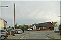
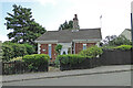
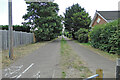
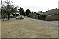
Photos of Lowestoft
Area Information
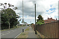
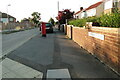
Living in Lowestoft means residing within a compact built-up area that spans just 21.7 square kilometres. Despite its small geographic footprint, the town supports a population of 36,012 people, resulting in a population density of 1,663 inhabitants per square kilometre. This density creates an environment where you are closer to your neighbours and local services than in sprawling rural settings. You find yourself in a town with distinct maritime heritage rather than a vast metropolis. The scale of Lowestoft ensures that daily movements require less travel time, yet the area maintains a structured residential character. You do not experience the isolation of the countryside, nor the relentless pace of a major city. Instead, daily life in Lowestoft balances the convenience of urban amenities with the relative calm of a regional town. The boundaries are clear, and the community feels defined by its coastal location. When you consider homes in Lowestoft, you are choosing a location where accessibility and community size remain manageable. The area functions as a self-contained unit where most essential needs fall within practical reach.
- Area Type
- Built Up Area 250
- Area Size
- 21.7 km²
- Population
- 36012
- Population Density
- 1663 people/km²
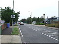
Your daily routine in Lowestoft is supported by a cluster of practical amenities located within a short walk or drive. Retail options include Lidl Oulton, Iceland Lowestoft, and Morrisons Lowestoft, giving you convenient access to essential groceries and household basics without needing a long journey. For those who prefer rail travel, five stations surround the area, including Oulton Broad North Railway Station and Oulton Broad South Railway Station. Oulton Broad South Railway Station offers direct links for commuters. You also have access to Beccles Airport, which provides connections for occasional travel needs. These facilities form the backbone of your lifestyle, ensuring comfort and convenience. You will not face long queues for basic shopping or struggle to find train tickets for weekend trips. The proximity of these amenities means you can run your errands efficiently while maintaining time for leisure. The town centre remains a functional hub where daily necessities are handled quickly and effectively.
Amenities
Schools
Families considering Lowestoft have several educational options directly adjacent to their potential homes. Carlton Colville Primary School operates as a primary institution with an outstanding Ofsted rating, offering a high standard of early education. Northfield St Nicholas Primary School and Roman Hill Primary School also serve as local primary facilities for younger children. St Margaret's Community Primary School completes the primary school list nearby, ensuring multiple choices for families with young children. For further education, Old Warren House School is situated as an other-type facility within the catchment area. This mix of outstanding primary provision and accessible community schools means you do not need to travel far for quality learning. The presence of multiple primary schools indicates a neighbourhood with established family infrastructure. You can select a school based on proximity or specific philosophy while remaining within the town limits. The educational landscape supports both traditional community schooling and alternative educational approaches.
| Rank | School | Type | Entry gender | Ages |
|---|
Explore more schools in this area
Go to Schools tabDemographics
The community in Lowestoft is defined by a very distinct age profile. The median age for residents is 70 years old, indicating that the town has a predominantly older population. While the data lists the most common age range simply as 'Total', the high median age suggests that many households consist of empty nesters or seniors. House ownership stands at 65%, which is a substantial figure indicating that owner-occupy remains the prevailing lifestyle for most families. This high rate of ownership implies stability within households and a resident base that has chosen to settle permanently rather than rent. The remaining 35% of the housing stock is occupied by private or social renters. You will find that accommodation types in the town reflect this demographic reality, likely favouring detached homes and bungalows over high-density blocks. Diversity data is classified as total, meaning specific ethnic breakdowns are not available in the current records. Similarly, detailed breakdowns for religion and household composition are marked as total in the provided information. When you buy a home in Lowestoft, you are purchasing a stake in a community with a mature demographic. The environment suits those who value quiet settings over youthful vibrancy.
Household Size
Accommodation Type
Tenure
Ethnic Group
Religion
Household Composition
Age
Household Deprivation
NS-SEC
Explore more demographic insights in this area
Go to Demographics tabPlanning
Planning Constraints
- Crime RiskPremium