Area Overview for Loughton St. John's Ward
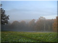
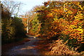
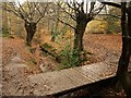
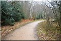
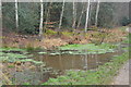
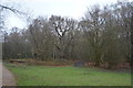
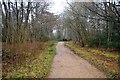
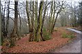
Photos of Loughton St. John's Ward
Area Information
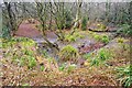
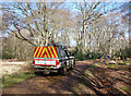
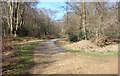
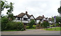
Living in Loughton St. John's Ward offers a defined residential experience within the Epping Forest District of Essex. This electoral ward forms a specific part of the larger town of Loughton, a location situated just outside central London but inside the M25 motorway orbital. The area covers a total land mass of 6.3 square kilometres, providing a compact community environment. As of 2021, the population stood at 4,492 residents, creating a neighbourhood of manageable scale where daily life likely revolves around local connection rather than urban sprawl. An example postcode for this location is IG10 2SD, which serves as a reference point for any property search. The ward was established in 1979 following a revision of boundaries within Epping Forest. It currently returns three councillors to Epping Forest District Council, giving residents direct representation in local decision-making. St. John's Church is a notable feature located within the ward, anchoring the community with a sense of local history and continuity. While the brickwork of its history dates back nearly half a century, the area continues to function as a distinct electoral unit with its own identity. Residents benefit from being close enough to London for travel yet positioned within a specific town structure that maintains a village-like feel. Your daily movement through this 6.3 km² zone connects you to established local services and the broader infrastructure of Loughton.
- Area Type
- District Borough Unitary Ward
- Area Size
- 6.3 km²
- Population
- Not available
- Population Density
- Not available
Demographics
The community in Loughton St. John's Ward is mature, with a median age of 70 years old. This demographic profile contrasts sharply with younger urban districts, suggesting the area appeals significantly to retirees or older couples rather than young families. The most common age range recorded in the population data is simply listed as "Age: Total", which indicates a broad spread across the older demographics. With 76% of homes owned outright, the area functions as a settled, owner-occupied neighbourhood where long-term residents have invested heavily in their properties. Accommodation types and household composition data are not broken down into specific categories in the available records, but the high ownership rate implies stability. Predominant ethnic groups, religious affiliations, and detailed household make-up statistics are available only as "Total" aggregates, meaning the specific cultural breakdowns are not quantified in the current dataset. However, the overwhelming prevalence of home ownership paints a picture of a community where residents have likely stayed for decades. This high level of tenure correlates with a demographic where life stages have evolved past the typical filled-by-property-cycle market. You are entering a settled community where residents value permanence over transience. The low youth population means local schools may see fewer daytime students compared to suburban family hubs, while local shops may cater to the needs of an older demographic.
Household Size
Accommodation Type
Tenure
Ethnic Group
Religion
Household Composition
Age
Household Deprivation
NS-SEC
Explore more demographic insights in this area
Go to Demographics tabPlanning
Planning Constraints
- Flood RiskPremium
- Ramsar Wetland SitesPremium
- Area of Outstanding Natural BeautyPremium
- Protected Nature ReservePremium
- Protected WoodlandPremium
- Crime RiskPremium