Area Overview for Loughton Fairmead Ward
Photos of Loughton Fairmead Ward


Area Information
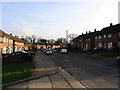
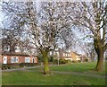
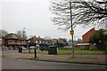
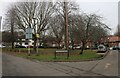
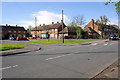
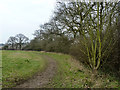
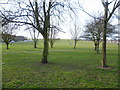
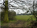
Loughton Fairmead Ward occupies a distinctive position within the landscape of Essex, situated just inside the M25 orbital motorway. This electoral ward spans 2.2 km² and forms part of the broader civil parish of Loughton, lying approximately 13 miles north-east of Charing Cross. The area is bounded by Epping Forest to the west and the Roding river valley to the east, positioning it centrally within the local topography. With a population of 1,462 residents, the ward maintains a low population density of 673 people per km². This figure indicates a neighbourhood that feels spacious yet remains integrated with the wider town. Living in Loughton Fairmead Ward offers a specific blend of suburban convenience and proximity to major transport arteries. The ward centres around geographic coordinates near the Fairmead area, providing access to key local services. Your daily life here benefits from the strategic location of Loughton, which sits on the border between Essex and Greater London. You can access the M11 motorway at junction 5 on the eastern boundary without leaving the town limits. This route links directly to London and Cambridge, making the commute feasible for professionals working in the capital or the county town. The physical setting is defined by its inclusion within Epping Forest District and its relationship with the surrounding river valleys. You are not in Greater London, yet the connectivity to Charing Cross creates a London-style pace of life. The ward serves as a residential anchor within this larger parish, offering a settled environment. Residents enjoy the advantages of being close to significant transport links while retaining the character of a suburban ward centred around Fairmead.
- Area Type
- District Borough Unitary Ward
- Area Size
- 2.2 km²
- Population
- 1462
- Population Density
- 673 people/km²
Demographics
The community within Loughton Fairmead Ward reflects a mature profile, with a median age of 70 years. This statistic identifies the area as one of the oldest in the district, suggesting a population composed largely of retirees or long-term residents. The most common age range is listed as 'Age: Total', indicating that the entire demographic structure leans towards this older cohort. With a total household composition and accommodation type data available only in aggregate form, you will find that the social fabric is built around an elder demographic. Home ownership is a dominant feature of this local scene, with 55% of residents owning their properties outright or with a mortgage. This majority ownership rate signifies that the ward is not a high-volume student or transient rental market. Instead, it functions as a stable residential zone where people put down deep roots. The high percentage of owners often correlates with families planning to stay for the long term or individuals seeking a quiet retirement setting. Diversity data lists the predominant ethnic group and religion only as 'total', meaning the specific breakdowns are presented as aggregate figures for the ward. This general categorisation reflects the wider patterns of the Loughton parish rather than highlighting specific minority concentrations within Fairmead. For those considering living in this ward, you are entering a community defined by stability and age. The social environment is shaped by the preferences and lifestyles of its 1,462 inhabitants. Your neighbours are likely to be established locals who value the established character of the street and the surrounding green spaces.
Household Size
Accommodation Type
Tenure
Ethnic Group
Religion
Household Composition
Age
Household Deprivation
NS-SEC
Explore more demographic insights in this area
Go to Demographics tabPlanning
Planning Constraints
- Flood RiskPremium
- Ramsar Wetland SitesPremium
- Area of Outstanding Natural BeautyPremium
- Protected Nature ReservePremium
- Protected WoodlandPremium
- Crime RiskPremium