Area Overview for Lolworth
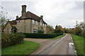
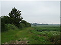
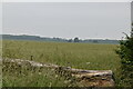
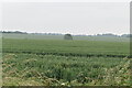
Photos of Lolworth
Area Information
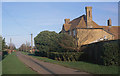
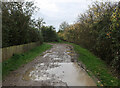
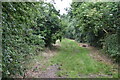
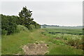
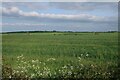
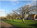
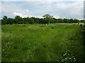
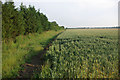
Lolworth is a small civil parish in South Cambridgeshire that covers only 4.5 km². This rural village sits approximately 8 miles northwest of Cambridge city centre. A distinctive geographical feature is that the Prime Meridian passes through the village about 50 metres to the west of the crossroads. The name derives from historical records listing it as *Lollesworthe* in 1034 and *Lolesuuorde* in the Domesday Book of 1086. Its position developed around the Via Devana, a Roman road connecting Cambridge to Huntingdon which later became a turnpike between 1772 and 1876. Daily life in Lolworth is tranquil due to its diminutive scale. The population has remained relatively steady at around 130 since 1961, though it peaked at 170 in 1871. A devastating fire caused by a thunderstorm in September 1393 caused a sharp decline, reducing taxpayers to just 17 by 1524. The former school converted into a village hall in 1960 by resident T. B. Robinson serves as the main community facility. You will find no public house in the village, as the only alehouse closed in 1798. Travel is via the A1307, which links to the A14 between Cambridge and Huntingdon. Living in Lolworth means embracing a quiet, history-rich existence far removed from modern urban hustle.
- Area Type
- Parish
- Area Size
- 4.5 km²
- Population
- Not available
- Population Density
- Not available
Demographics
The community in Lolworth has an exceptionally elderly demographic profile. The median age is 70 years, with the age data categorised under the total population count. This indicates a significant proportion of residents are senior citizens. Household composition data is recorded for the total population, while accommodation types and predominant ethnic groups are recorded for the total. There are no specific breakdowns provided for household types or ethnic diversity beyond the general total category. Transit data for the total population confirms the village's reliance on car travel due to its remote location. Home ownership stands at a high 73%, suggesting stability among those who do reside there. No specific data on private renting or social housing is included in the available records. Religion and specific ethnic group details are recorded only for the total population. Living in Lolworth implies joining a community where older generations dominate the social fabric. You should be aware that the resident base is not young or family-centric by modern standards. The 73% ownership rate further cements this as an established area rather than a developing rental market. Historical factors likely contribute to this age skew after the population stabilised at low levels post-1961.
Household Size
Accommodation Type
Tenure
Ethnic Group
Religion
Household Composition
Age
Household Deprivation
NS-SEC
Explore more demographic insights in this area
Go to Demographics tabPlanning
Planning Constraints
- Flood RiskPremium
- Ramsar Wetland SitesPremium
- Area of Outstanding Natural BeautyPremium
- Protected Nature ReservePremium
- Protected WoodlandPremium
- Crime RiskPremium