Area Overview for Little Wratting
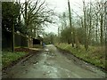
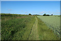
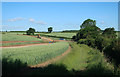
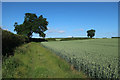
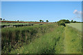
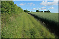
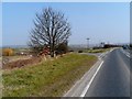
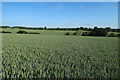
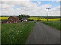
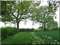
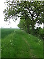
Photos of Little Wratting

Area Information
Living in Little Wratting means settling into a small, rural civil parish within the West Suffolk district of eastern England. This quiet village occupies just 2.9 km² and sits on the north-eastern edge of the town of Haverhill. You are looking at a location defined by its proximity to a larger settlement while maintaining a distinct village character. The area represents a traditional English village setting rather than a developed urban environment. Daily life here revolves around the practicalities of village living where space is limited but connectivity to nearby towns remains straightforward. The compact nature of the parish offers a contained community feel, making it easy to navigate without the complexities of major road networks. Residents enjoy the benefits of being close to Haverhill while retaining the slower pace associated with living in the countryside. The geographical positioning at approximately 52.1016°N 0.4759°E places you firmly within the historic landscape of Suffolk. Your routine is shaped by local amenities and the proximity to regional services found in Haverhill. This area suits those seeking a grounded lifestyle away from city congestion. The physical boundaries of the parish create a defined sense of place that persists regardless of seasonal changes.
- Area Type
- Parish
- Area Size
- 2.9 km²
- Population
- Not available
- Population Density
- Not available
Demographics
The community in Little Wratting is shaped by an older population profile suitable for retirement or later-life living. The median age across the area stands at 70, indicating that the demographic is skewing significantly towards seniors. Data confirms that the most common age range spans the broader category of Total Age groups, reflecting a settled population without a large youth cohort. Home ownership dominates the housing landscape with a striking 70% of residents owning their property outright or with a mortgage. This high level of ownership suggests a long-term commitment from people who have chosen to put down roots. The remaining 30% of the resident population likely consists of private renters or housing association tenants. The provided information does not detail specific household composition figures beyond the total category, nor does it specify predominant ethnic groups or religious affiliations. You will find a community where stability is evident through property ownership rates. The age distribution implies that residents may rely on local healthcare provisions and age-appropriate social facilities. There are no data points provided regarding deprivation levels or specific income statistics to further describe quality of life metrics. The prevailing characteristic remains the high rate of homeownership amidst an elderly demographic.
Household Size
Accommodation Type
Tenure
Ethnic Group
Religion
Household Composition
Age
Household Deprivation
NS-SEC
Explore more demographic insights in this area
Go to Demographics tabPlanning
Planning Constraints
- Flood RiskPremium
- Ramsar Wetland SitesPremium
- Area of Outstanding Natural BeautyPremium
- Protected Nature ReservePremium
- Crime RiskPremium