Area Overview for Little Whelnetham
Photos of Little Whelnetham
Area Information
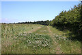
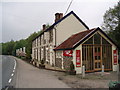
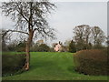
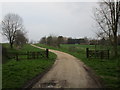
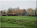
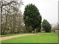
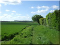
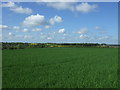
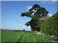
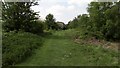
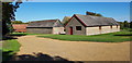
Little Whelnetham is a small civil parish covering an area of just 2.2 square kilometres. This compact footprint defines the pace of daily life, where distances are short and the community feels intimate. Living in Little Whelnetham means experiencing a rural setting without the anonymity of larger settlements. The size of the parish suggests a layout that prioritises access to green space over dense urban development. You will find that the daily commute to nearby towns is a key part of the routine, given the limited local amenities within the 2.2 km² boundary. The character of the parish is shaped by its status as a distinct administrative area, separate from the larger villages that surround it. Prospective buyers looking for homes in Little Whelnetham should expect a environment that values quietude. The small scale of the location ensures that you are never far from the edges of the parish where roads widen to connect with major transport routes. This geographic constraint also means that local services rely heavily on travel to neighbouring hubs. The area maintains its identity as a standalone community, offering a clean slate for those seeking a traditional English village experience. Understanding the dimensions of Little Whelnetham helps you appreciate the trade-off between seclusion and access. You gain a settled, small-scale feel while accepting that convenience requires a short journey beyond the parish lines.
- Area Type
- Parish
- Area Size
- 2.2 km²
- Population
- Not available
- Population Density
- Not available
Demographics
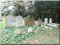
The community profile of Little Whelnetham reveals a population with a median age of 70 years. This figure indicates a settlement where retirement and established families dominate the demographic landscape. Most residents fall into older age brackets, which shapes the local demand for specific amenities and services. The high median age suggests that schools near Little Whelnetham are primarily those located in neighbouring districts rather than within the parish itself. Home ownership stands at 80 per cent, reflecting a stable community where long-term residents hold title to their properties. This high rate of ownership contrasts with areas where council housing or private renting form a significant portion of the stock. The household composition data confirms that the population is largely settled, with fewer transient households moving through the area annually. While specific ethnic and religious breakdowns are not detailed in the current records, the demographic stability supports a consistent community culture. Deprivation metrics are not available for this area, yet the high home ownership rate often correlates with greater financial independence among residents. When considering homes in Little Whelnetham, you are entering a market defined by age and stability. The population structure ensures that any development or service provision must cater to an older demographic. This does not diminish the quality of living in Little Whelnetham but rather defines the social rhythm of the parish. The 80 per cent ownership figure is a key indicator of a non-transient, well-established neighbourhood. You should be aware that family life here often centres around retirement or grew-up children returning to the village. The demographic data paints a picture of a community with roots deep in the local soil.
Household Size
Accommodation Type
Tenure
Ethnic Group
Religion
Household Composition
Age
Household Deprivation
NS-SEC
Explore more demographic insights in this area
Go to Demographics tabPlanning
Planning Constraints
- Flood RiskPremium
- Ramsar Wetland SitesPremium
- Area of Outstanding Natural BeautyPremium
- Protected Nature ReservePremium
- Protected WoodlandPremium
- Crime RiskPremium