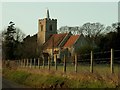
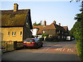
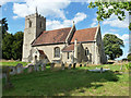
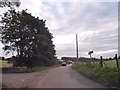
Area Overview for Little Munden

All Saints church, Little Munden, Herts. in Little Munden
Dane End: Munden Road in Little Munden
Little Munden church in Little Munden
Junction on Munden Road, Dane End in Little Munden
Munden Road, Dane End in Little Munden
Little close in Dane End in Little Munden
Turn right to Haultwick in Little Munden
Bungalow on Munden Road, Dane End in Little Munden
Little Munden Primary School in Little Munden
Little Munden Memorial Hall, Dane End in Little Munden
Lanes meet near Dane End, Hertfordshire in Little Munden
Dane End playing field in Little Munden
28 photos from this area

Area Information

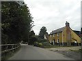
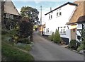
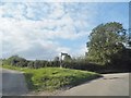
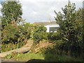
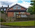
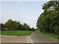
Adapting to life in Little Munden means accepting the character of a small, rural civil parish in Hertfordshire. This community spans 11.3 square kilometres, offering a contained and intimate setting rather than the sprawl found in larger towns. The area functions as a distinct pocket of the wider neighbourhood, providing a quiet atmosphere for those who prioritise space over urban convenience. Residents here experience a lifestyle defined by its modest scale and established charm, suitable for individuals seeking a retreat from city noise. When you consider homes in Little Munden, you are entering a space where daily life revolves around local resources and the surrounding countryside. The parish nature of the settlement suggests a history of tight-knit community interaction, though the specific demographic nuances become clearer only when examining local statistics. Living in this area requires a willingness to manage your own needs, as the infrastructure is tuned to a population that values stability and tradition. The layout of the parish supports a slower pace of life, removing the urgency often associated with high-density urban environments. It is a place for those who wish to settle in a defined geographical area without the chaos of metropolitan transport networks injecting themselves into your routine.

Area Type
Parish
Area Size
11.3 km²
Population
Not available
Population Density
Not available

Demographics

Household Size

total
most common

Accommodation Type

total
most common

Tenure

76
majority

Ethnic Group

total
most common

Religion

total
most common

Household Composition

total
most common

Age

70
median
Age: Total
most common

Household Deprivation

N/A
with no deprivation

NS-SEC

40
in Lower managerial occupations

Explore more demographic insights in this area

Go to Demographics tab

Planning

Planning Constraints

  • Flood Risk
    Premium
  • Ramsar Wetland Sites
    Premium
  • Area of Outstanding Natural Beauty
    Premium
  • Protected Nature Reserve
    Premium
  • Protected Woodland
    Premium
  • Crime Risk
    Premium

Explore more planning insights in this area

Open Planning map

Frequently Asked Questions

Who typically lives in Little Munden and what is the community feel like?
The community in Little Munden has a median age of 70, indicating a mature population dominated by older adults. Home ownership is high at 76%, which fosters a stable, long-term resident base. This demographic profile creates a quiet, settled atmosphere rather than a bustling family hub, making it ideal for those seeking a peaceful retirement or a permanent country residence.
How is digital connectivity for working from home in Little Munden?
Residents should expect a fair fixed broadband connection with a quality score of 49 out of 100. While this supports basic browsing and checking email, high-bandwidth tasks like large video meetings may be limited. However, mobile coverage is significantly better, scoring 82 out of 100. This means your phone network is reliable, though your home internet may struggle with heavy usage demands.
Is Little Munden a safe place to live environmentally and criminally?
Yes, the area scores well on safety metrics. You will find a low flood risk score of 4.47 and a crime risk score of 77, which signifies below-average crime rates compared to other regions. The parish also has no coverage for Ramsar sites or Areas of Outstanding Natural Beauty, ensuring no major wetland planning constraints exist. The primary caution is a warning level score of 3.86 for protected woodland, which affects only specific zones within the 11.3 square kilometre area.

We use cookies to provide you with the best experience. By continuing, you agree to our Cookie Policy .