Area Overview for Little Horkesley
Photos of Little Horkesley
Area Information
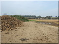
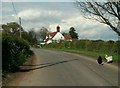
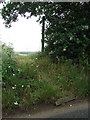
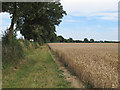
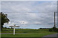
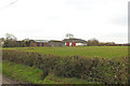
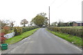
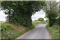
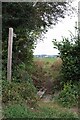
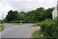
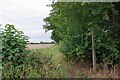
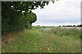
Living in Little Horkesley offers a distinctly rural experience within a civil parish covering 5.2 km². You will find a quiet setting that feels removed from the noise of larger towns, yet it remains part of the extensive local network. The small footprint means every corner is easily accessible on foot, fostering a neighbourhood where local life revolves around community rather than traffic. This area is characterised by a settled pace, ideal for those prioritising peace over urban convenience. The landscape itself presents specific planning constraints, as parts of the parish fall within an Area of Outstanding Natural Beauty. You must also note the presence of protected woodland within these boundaries, which shapes the local environment and development potential. Residents enjoy a low flood risk environment, with assessments confirming safe conditions for daily living. The absence of Ramsar wetland sites or protected nature reserves suggests a terrestrial focus rather than marshland preservation. While the natural beauty offers scenic value, the AONB designation acts as a strict guideline for any construction or renovation projects you might consider. Daily life here is defined by these conservation layers, ensuring that the landscape remains intact for future generations. You are buying into a landscape where nature conservation takes precedence over rapid expansion.
- Area Type
- Parish
- Area Size
- 5.2 km²
- Population
- Not available
- Population Density
- Not available
Demographics
The community in Little Horkesley has a clear demographic profile defined by age and tenure. Households are led predominantly by residents in their seventies, with the median age standing at exactly 70 years old. This indicates a settlement where tradition and permanence outweigh transient living arrangements. Consequently, home ownership is extremely high, with 77% of residents owning their properties outright. This figure creates a stable community where families have deep roots and long-term commitment to the area. The household composition reflects this stability, suggesting a population geared towards established living rather than seasonal occupation or student housing. You will not find a youthful influx driving the local economy, but rather a settled group maintaining the area's character. While the provided data does not detail specific ethnic groups or religious affiliations, the high ownership rate implies a stable resident base likely to resist rapid demographic shifts. For buyers interested in the local culture, the age profile suggests a senior-friendly environment with specific needs for medical services and accessibility. The community feels like one that has evolved slowly over decades, benefiting from the continuity of long-term residents who know every street and history of the parish.
Household Size
Accommodation Type
Tenure
Ethnic Group
Religion
Household Composition
Age
Household Deprivation
NS-SEC
Explore more demographic insights in this area
Go to Demographics tabPlanning
Planning Constraints
- Flood RiskPremium
- Ramsar Wetland SitesPremium
- Area of Outstanding Natural BeautyPremium
- Protected Nature ReservePremium
- Protected WoodlandPremium
- Crime RiskPremium