Area Overview for Little Clacton
Photos of Little Clacton


Area Information
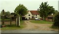
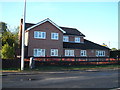
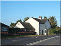
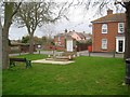
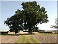
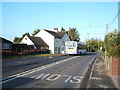
Little Clacton is a compact built-up area covering just 1.1 square kilometres. You will find yourself in a densely settled town with a very stable local character. The population is dominated by a mature demographic, with a median age of 70 years. This profile distinguishes the location as a residential hub for older residents rather than a development spot for young families or commuters. Life here revolves around the established community fabric of a small English town. The setting offers a quiet domestic rhythm, defined by its limited footprint which concentrates daily activities within a short walking distance. You can expect a neighbourhood where locals know each other well, given the high rate of home ownership. This area does not sprawl; instead, it presents a contained environment where the boundaries of town and countryside are close. When considering homes in Little Clacton, you are purchasing into a space that has defined a specific way of life for decades. The physical scale of the area ensures that the community feels intimate, and there are few surprises regarding the layout or the speed of life on a Saturday morning.
- Area Type
- Built Up Area 250
- Area Size
- 1.1 km²
- Population
- Not available
- Population Density
- Not available
Your daily life in Little Clacton benefits from a cluster of amenities located within practical reach. Retail services are well-supported by five local outlets, including Morrisons at Burrsville Park Clacton-on, Lidl at Brook Park West, and M&S in Clacton. These specific venues provide a complete range of supermarket and high-street shopping without the need to drive far to neighbouring towns. Transport links加强了 connectivity, with five railway options including the Weeley Railway Station, Thorpe Railway Station, and Clacton station nearby. You can access the national rail network easily for trips to London or other coastal destinations. Furthermore, three ferry landing points – Brightlingsea, Point Clear, and East Mersea – offer direct links across the estuary. This combination of rail and ferry access makes Little Clacton a surprisingly versatile location for holidaymakers or island visitors. The proximity of these six to eight major transport hubs defines the lifestyle here. You might complete your weekly shop at Lidl and then head directly to the train station for a weekend away. The convenience of having multiple distinct modes of transport near Little Clacton distinguishes it from purely rural retreats.
Amenities
Schools
There is one primary school recorded in the immediate vicinity of Little Clacton. Engaines Primary School and Nursery operates in the local area and holds a good rating from Ofsted. This single institution serves the educational needs of the very small population of younger children residing within the town's limits. The presence of a nursery alongside the primary facility suggests that families looking to buy here must plan carefully regarding childcare. The school's good rating provides reassurance for parents, yet the limited number of options reflects the area's demographic reality. There are no secondary schools or specialist academies listed for Little Clacton in the provided data. You will likely need to commute further to find older children's education if you relocate with teenagers. The school mix is straightforward, consisting of just one good-rated primary education provider. This concentration of schools near the homes in Little Clacton confirms the town's function as a retirement hub rather than a school-going district.
| Rank | School | Type | Entry gender | Ages |
|---|
Explore more schools in this area
Go to Schools tabDemographics
The community in Little Clacton is defined by stability and longevity. Home ownership stands at an exceptional 87%, meaning that nearly nine out of every ten residents are living in houses or flats they own outright. This figure indicates a decisive lack of speculative rental activity and a deep-rooted commitment to the locality by its inhabitants. The age profile reinforces the quiet nature of the area, with a median age of 70. This statistic reflects a settlement where families often move away after raising children, leaving a legacy of long-term residents. While the data for household composition and ethnic diversity is not detailed in the provided records, the high ownership percentage suggests a community that has grown organically over many years. You are looking at an area where residents have likely lived through significant national and local changes. The housing stock mirrors this tenure profile, with very little indication of temporary or short-term accommodation. This demographic makeup creates an environment where noise levels remain low and neighbourhood disputes are rare, provided the established social order is respected.
Household Size
Accommodation Type
Tenure
Ethnic Group
Religion
Household Composition
Age
Household Deprivation
NS-SEC
Explore more demographic insights in this area
Go to Demographics tabPlanning
Planning Constraints
- Crime RiskPremium