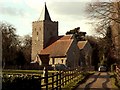
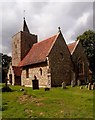
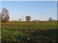
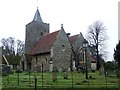
Area Overview for Little Bardfield
Photos of Little Bardfield

Area Information
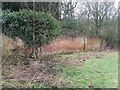
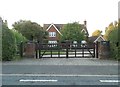
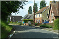
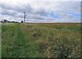
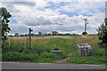
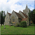
Living in Little Bardfield means residing in a compact civil parish covering 8.7 square kilometres. This small rural community sits quietly within the broader Essex landscape, offering a distinct pace of life far removed from the rush of urban centres. You will find that the area maintains a strong sense of locality while remaining close to regional hubs. The sheer size of the parish is modest, which often results in a manageable commute and a feel for your entire neighbourhood. Daily life here is defined by a lack of sprawl, meaning travels to schools, shops, or leisure facilities remain brief. The proximity of the boundary also means you are situated near other larger villages, giving you access to more extensive services without sacrificing the rural character you likely seek. When you consider homes in Little Bardfield, you are entering a market where the layout supports a traditional country lifestyle. The surrounding countryside provides immediate access to fresh air and open spaces, yet the infrastructure required for modern living remains intact. This balance attracts those who want the silence of the fields with the connectivity of the digital age. The area does not suffer from significant planning constraints regarding flood risk or protected wetlands, allowing for a stable environment for future property development. You can expect a setting where the land is safe from major environmental threats, ensuring that your long-term investment remains secure against natural hazards.
- Area Type
- Parish
- Area Size
- 8.7 km²
- Population
- Not available
- Population Density
- Not available
Demographics
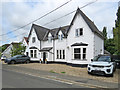
The community profile of Little Bardfield reveals a settlement dominated by older residents. The median age stands at 70 years, indicating that the population consists largely of retirees or those approaching retirement. This age structure suggests a stable environment where the primary demographic seeks quiet homes rather than multi-generational family spaces. You will encounter fewer young families compared to other growing villages, as the median age skews heavily towards senior living. This demographic reality shapes the local shops and amenities, catering to an older lifestyle that prioritises convenience and comfort. Home ownership remains incredibly high within the parish, with 78% of residents owning their property outright. This substantial figure points to an area where people stay put for decades, investing deeply in their local community. You are likely to meet neighbours who have lived in the same village for many years, fostering a sense of long-term stability. The high rate of ownership also means that when you look at accommodation types, you will see a prevalence of private residences rather than council housing or private rental schemes. The household composition reflects this stability, with residents focused on maintaining their existing properties rather than renting. This environment creates a neighbours network built on permanence rather than transience.
Household Size
Accommodation Type
Tenure
Ethnic Group
Religion
Household Composition
Age
Household Deprivation
NS-SEC
Explore more demographic insights in this area
Go to Demographics tabPlanning
Planning Constraints
- Flood RiskPremium
- Ramsar Wetland SitesPremium
- Area of Outstanding Natural BeautyPremium
- Protected Nature ReservePremium
- Protected WoodlandPremium
- Crime RiskPremium