Area Overview for Lidlington
Photos of Lidlington


Area Information
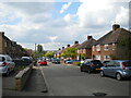
Lidlington sits as a built-up area in Bedfordshire, covering a total of 41.5 hectares. It is a residential pocket rather than a macro-city, offering a quieter pace of life compared to larger urban centres. Residents here enjoy a defined sense of place within the greater Maidstone market area. The community is characterised by stability, with a high proportion of people putting down roots in the local estate. You are likely to find a neighbourhood where daily routines revolve around local amenities and established routines rather than the frantic rhythm of major metropolises. The area functions as a solid, practical choice for those seeking a home outside the immediate city fringe but still close to broader transport links. Living in Lidlington means embracing a compact environment where you can maintain close ties to your immediate surroundings. The physical footprint of the area supports a contained lifestyle, allowing you to reach key destinations without excessive travel time. This balance of space and proximity defines the modern appeal of the location for potential buyers.
- Area Type
- Built Up Area 250
- Area Size
- 41.5 hectares
- Population
- Not available
- Population Density
- Not available
Your daily lifestyle in Lidlington benefits from a cluster of essential amenities within practical reach. You have access to five notable railway stations, including Lidlington Railway Station, Millbrook Railway Station, and Ridgmont Railway Station. These transport hubs provide straightforward links to wider networks for commuting or occasional travel. For shopping needs, five retail outlets serve the residents, featuring Co-op Marston, The Southern Co-operative Co, and Waitrose Ampthill. These specific names indicate a range of grocery and daily provision options without needing to travel far. Additionally, Cranfield Airport sits as a five-minute airport facility nearby, offering fast air travel connections for those with international or business requirements. Living in Lidlington means having these core services integrated directly into your local transport and consumer map. The proximity to diverse shopping venues and major transport nodes ensures convenience is never far from your doorstep. This accessibility allows you to manage household errands and travel plans efficiently from your home.
Amenities
Schools
Families considering Lidlington have one primary educational option immediately adjacent to their homes. Thomas Johnson Lower School operates as a primary institution within the neighbourhood. The school holds an Ofsted rating of good, which meets the standard expectations for local education provision. While this single primary option is clearly identified in the data, the absence of secondary school listings in the immediate locality means families may need to travel further for comprehensive education. The presence of a good-rated primary school ensures that young children receive a solid start to their academic journey without leaving the local parish. Living in Lidlington means sending your younger children to a school with a verified positive reputation nearby. Parents planning for secondary education should research options in surrounding boroughs, as this specific dataset only confirms the local primary provision. The focus on Thomas Johnson Lower School indicates a dedicated focus on younger years within the community infrastructure.
| Rank | A + A* % | School | Type | Entry gender | Ages |
|---|---|---|---|---|---|
| 1 | N/A | Thomas Johnson Lower School | primary | N/A | N/A |
Explore more schools in this area
Go to Schools tabDemographics
The community in Lidlington reflects a settled population with a median age of 70 years. This high median age suggests the area attracts older residents who have chosen a permanent home in the region. Nearly three-quarters of the households, or 77%, consist of owner-occupiers. This statistic confirms that buying property in Lidlington is a key aspiration for many families bringing assets to the community. The high rate of home ownership indicates a stable resident base rather than a transient rental market. While specific figures on household composition and predominant ethnic groups are not detailed in the current records, the dominant age profile paints a clear picture of the local demographic. You should expect to live among neighbours who have invested long-term in their properties. This demographic skew towards older age groups often correlates with a lower noise level and a stronger focus on quiet, well-maintained neighbourhoods. Understanding that the area is weighted heavily towards older residents helps you gauge the local vibe and service needs effectively.
Household Size
Accommodation Type
Tenure
Ethnic Group
Religion
Household Composition
Age
Household Deprivation
NS-SEC
Explore more demographic insights in this area
Go to Demographics tabPlanning
Planning Constraints
- Crime RiskLocked