Area Overview for Lidgate
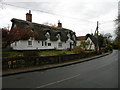
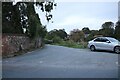
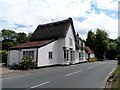
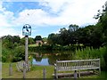
Photos of Lidgate


Area Information
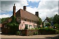
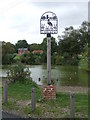
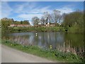
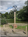
Living in Lidgate offers a contained experience within a built-up area spanning 24.2 hectares. Located in England, this pocket of countryside provides a specific residential environment distinct from larger cities. You will find a neighbourhood defined by its size limits, which naturally constrain population density and control the pace of daily life. The area functions as a self-contained community where residents make do with local facilities rather than relying on extensive urban infrastructure. This location suits individuals seeking a quieter existence away from the commute-heavy lifestyle of central Newmarket. The physical boundaries of the neighbourhood mean you navigate a landscape designed for local living rather than through-traffic. When you consider homes in Lidgate, you are entering an environment where the setting plays a significant role in your day-to-day routine. The area does not boast the scale of a town centre but offers a focused residential zone suitable for those prioritising space and tranquility over urban vibrancy. You will encounter a community where the sheer volume of dwellings is managed within a relatively small footprint. This concentration creates a tight-knit atmosphere, though the exact number of residents fluctuates with market movements. The area demands a pragmatic approach to daily needs, as amenities are situated just outside the immediate built-up zone. Residents often plan their week around visits to nearby stations and shops, integrating small journeys into a larger routine. This setup provides a predictable and low-stress living arrangement for households who value simplicity and proximity to green spaces.
- Area Type
- Built Up Area 250
- Area Size
- 24.2 hectares
- Population
- Not available
- Population Density
- Not available
Your daily life in Lidgate revolves around specific, accessible venues that cater to essential conveniences. Within practical reach, you have access to four railway stations, ensuring straightforward connectivity to the wider network. Newmarket Railway Station stands as the primary interchange, supported by Entrance 1 and Entrance 2, allowing you to travel beyond the immediate vicinity. These stations form the backbone of your commute and leisure travel, keeping you linked to Newmarket and adjacent towns. For your weekly shopping, four retail outlets sit conveniently nearby. You will find a Spar for essential groceries and a selection of household goods. M&S at the Hyperion BP provides staple foods and discounted items close to your doorstep. Iceland Newmarket offers frozen foods and home products, rounding out your perimeter shops. These locations mean you can complete errands without leaving the local area, reducing dependence on private car transport. The area also supports small-scale fuel needs with a BP station integrated into the retail offering. This combination of transport and retail nodes creates a functional lifestyle where key tasks are performed locally. However, the built-up area does not extend into a commercial hub with cinemas, restaurants, or extensive entertainment. Your lifestyle is defined by utility and access to key services rather than leisure-centric amenities. You must plan entertainment or dining outings to further afield, as the local tattoo is focused on practicality and transport links.
Amenities
Schools
| Rank | School | Type | Entry gender | Ages |
|---|
Explore more schools in this area
Go to Schools tabDemographics
The community in Lidgate features a notably older population, with a median age of 70. This figure indicates that the majority of residents are retired individuals or senior citizens. While the data does not specify the most common age range beyond the total count, the median strongly suggests a demographic dominated by those over the retirement years. Consequently, you should expect a neighbourhood character shaped by long-term residents rather than young families or students. Home ownership stands at 71% within this community. This high percentage confirms that the area is primarily occupied by people who have purchased their residences. You are unlikely to encounter a temporary influx of renters; instead, the housing stock is stabilised by owners with long-term ties to the location. This homeownership ratio typically correlates with a lower turnover rate in the local market, fostering a sense of permanence among neighbours. Diversity data and specific breakdowns of ethnic groups or religious affiliations are not detailed in the available statistics. However, the concentration of retirees often implies a homogeneity in values and lifestyle preferences, particularly regarding quiet environments and established routines. The accommodation composition reflects this stability, with properties likely suited for older tastes and needs. When you look for schools near Lidgate, you may find them hosted in nearby towns rather than within the immediate boundaries, given the demographic skew. The absence of young children in the population aligns with the older median age and the observational lack of primary school data within this specific zone.
Household Size
Accommodation Type
Tenure
Ethnic Group
Religion
Household Composition
Age
Household Deprivation
NS-SEC
Explore more demographic insights in this area
Go to Demographics tabPlanning
Planning Constraints
- Crime RiskPremium