Area Overview for Lewsey Ward
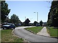
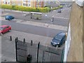
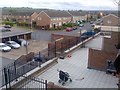
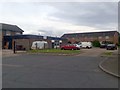
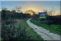
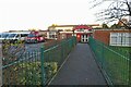
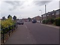
Photos of Lewsey Ward

Area Information
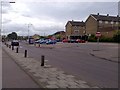
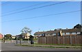
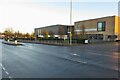
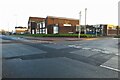
Living in Lewsey Ward offers a specific postcode experience within Luton Borough Council. This electoral ward covers a compact footprint of just 1.5 km² along the Eastern region of Luton, Bedfordshire. You will find the suburb situated at approximately 51.90°N, 0.48°W, bordered by Vincent Road and Torquay Drive to the north, and Roman Road to the south. High Street lies to the north, while the M1 motorway forms the western boundary. The area contains a population of 1,726 residents. Daily life centres around specific local landmarks such as the Lewsey Park Football Pavilion and Lewsey Sports Park. St Hugh's Church sits near the Luton and Dunstable University Hospital, which anchors the southern end of the vicinity. Educational options include The Chalk Hills Academy nearby, alongside Southfield Primary School. Residents also have access to the Lewsey Farm Learning Centre. This ward sits between neighbouring suburbs like Leagrave and Hockwell Ring, placing you within a defined community bounded by significant infrastructure and key institutions.
- Area Type
- District Borough Unitary Ward
- Area Size
- 1.5 km²
- Population
- 1726
- Population Density
- 1189 people/km²
Demographics
The people living in Lewsey Ward show a distinct demographic profile. The community skews significantly older, with a median age of 70 years. While the data categorises the most common age range simply as "Total," the high median age indicates a resident population that is not heavily weighted towards young families or children. This is one of the few areas in the wider region with such an advanced age profile. Housing stability is a notable feature here. You will find that half of the households, or 50%, are owner-occupied. This suggests a community where many residents have established long-term roots rather than being transient tenants. The ward's household composition and accommodation types reflect this settled nature, though specific breakdowns of property floors or tenancy spells are not detailed beyond the overall ownership figure. Ethnic and religious demographics are recorded as total figures in the available records, meaning no specific percentages are published for these categories. However, the population density stands at 1,189 people per km². This density confirms a relatively compact neighbourhood where most residents live close together within the small 1.5 km² area.
Household Size
Accommodation Type
Tenure
Ethnic Group
Religion
Household Composition
Age
Household Deprivation
NS-SEC
Explore more demographic insights in this area
Go to Demographics tabPlanning
Planning Constraints
- Flood RiskPremium
- Ramsar Wetland SitesPremium
- Area of Outstanding Natural BeautyPremium
- Protected Nature ReservePremium
- Protected WoodlandPremium
- Crime RiskPremium