Area Overview for Levington
Photos of Levington

Area Information
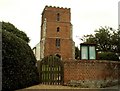
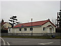
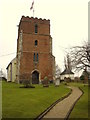
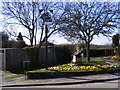
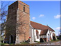
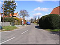
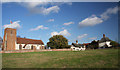
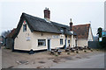
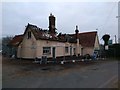
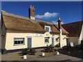
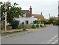
Levington is a small rural parish in East Suffolk, situated approximately five miles south-east of Ipswich on the River Orwell. The civil parish covers an area of 4.9 square kilometres, providing a rural setting defined by its proximity to nature rather than urban development. At the 2011 Census, the population, including Stratton Hall, stood at 259 residents, indicating a village with a distinct boutique character. This small population size often fosters a tight-knit atmosphere, which aligns with the Parish Council's description of the area as a vibrant and caring community set in a treasured landscape. Living in Levington means acknowledging a history that stretches back to 1086, when the manor supported 14 households. The village maintains its historic identity through locations such as St Peter's Church and Levington Lagoon, a five-hectare nature reserve managed by the Suffolk Wildlife Trust. Residents benefit from local social infrastructure, including a village hall that hosts organisations like the Women's Institute and the Gardening Club. The presence of The Ship Inn and regular coffee mornings further supports daily social interaction. While the River Orwell offers recreational access via Church Field, the village's isolation from major commercial hubs means daily life centres on local initiatives and the larger town of Ipswich for broader shopping and services. This setting suits those seeking a quiet existence away from the busy motorway networks of the east.
- Area Type
- Parish
- Area Size
- 4.9 km²
- Population
- Not available
- Population Density
- Not available
Demographics
The community profile of Levington reflects a predominantly settled population with clear indications of long-term residency. The most recent data indicates a median age of 70 years, suggesting the village attracts and retains older residents more than younger families or professionals. Since the median age is 70, the resident base is skewed significantly towards later life stages. This age profile influences local service needs and social activities, focusing heavily on those in retirement. The area shows a strong attachment to the location, demonstrated by a home ownership rate of 84 per cent. Such a high level of ownership implies that most residents have lived in their homes for extended periods rather than renting or temporarily residing there. Household composition within Levington varies but is heavily influenced by the ageing demographic, though specific breakdown figures for single-person or family units are not detailed in the current dataset. The accommodation types available reflect this need for varied living spaces suitable for different life stages. Ethnically and religiously, the area appears diverse, but the most common subgroupings are not quantified in the provided records. The high proportion of owner-occupiers usually suggests financial stability and a deep connection to the village. For anyone considering living in Levington, understanding this demographic reality is crucial. You are entering a community where the social fabric is woven by older generations, and the cultural rhythm of the parish will echo accordingly.
Household Size
Accommodation Type
Tenure
Ethnic Group
Religion
Household Composition
Age
Household Deprivation
NS-SEC
Explore more demographic insights in this area
Go to Demographics tabPlanning
Planning Constraints
- Flood RiskLocked
- Ramsar Wetland SitesLocked
- Area of Outstanding Natural BeautyLocked
- Protected Nature ReserveLocked
- Protected WoodlandLocked
- Crime RiskLocked