Area Overview for Leighton-Linslade North Ward
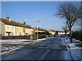
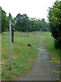
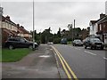
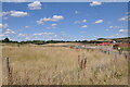
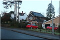
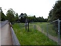
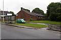
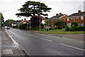
Photos of Leighton-Linslade North Ward
Area Information
Leighton-Linslade North Ward sits within the Leighton-Linslade borough unitary authority in England. This district covers a total area of 6.0 square kilometres. It holds a population of 2144 residents. That density results in 356 people per square kilometre. The ward represents a specific neighbourhood within the broader town. You will find home ownership levels remain high here. The community reflects a settled demographic with a significant portion of older residents. Digital infrastructure supports modern living needs effectively. Flooding presents a known consideration for property owners in this location. You face medium flood risk coverage across parts of the ward. Conversely, the area avoids major planning constraints typical of protected landscapes. There is no Ramsar wetland coverage in this specific district. No Area of Outstanding Natural Beauty coverage impacts building potential here. Protected nature reserves and protected woodland also maintain zero coverage. Crime statistics show a safer neighbourhood with below-average crime rates. A safety score of 79 out of 100 confirms this positive trend. Living in Leighton-Linslade North Ward offers a settled environment with clear data on risk and ownership. Homes in Leighton-Linslade North Ward appeal to those prioritising low crime and stable communities.
- Area Type
- District Borough Unitary Ward
- Area Size
- 6.0 km²
- Population
- 2144
- Population Density
- 356 people/km²
Demographics
The community profile of Leighton-Linslade North Ward shows a distinct demographic skew. The median age stands at 70 years old. You will find this is significantly older than most national averages. This age profile influences how services operate daily in the area. Home ownership proves dominant with 74 per cent of households on the books as owners. The remaining 26 per cent rely on other tenures. Detailed breakdowns for household composition and predominant ethnic groups remain unspecified in current records. You must focus on the tangible ownership figures instead. Religion statistics are similarly not disclosed for this specific unit. The low population density of 356 people per square kilometre creates a quiet residential atmosphere. This ward does not match the profile of a young, transient student hub. Instead, the 356 people/km² figure suggests a sparse, established settlement pattern. When evaluating homes in Leighton-Linslade North Ward, expect a neighbourhood where long-term residents hold the majority of properties. Living in Leighton-Linslade North Ward means joining a community defined by this high level of residential tenure.
Household Size
Accommodation Type
Tenure
Ethnic Group
Religion
Household Composition
Age
Household Deprivation
NS-SEC
Explore more demographic insights in this area
Go to Demographics tabPlanning
Planning Constraints
- Flood RiskPremium
- Ramsar Wetland SitesPremium
- Area of Outstanding Natural BeautyPremium
- Protected Nature ReservePremium
- Protected WoodlandPremium
- Crime RiskPremium